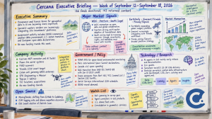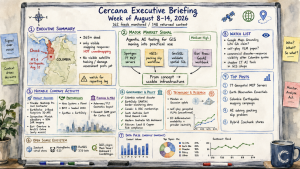

Cercana Executive Briefing: June 27 – July 10, 2026

Two-week edition covering June 27–July 10, 2026. 162 feeds monitored. Published July 10, 2026. The prior week was not published separately due to the Independence Day Holiday.

Executive Summary

Over the past two weeks, vendors, standards bodies, and industry voices all pointed in the same direction: AI agents are becoming a practical way to access geospatial tools. Safe Software introduced an FME bridge to the Model Context Protocol (MCP), allowing GIS workflows to be exposed as callable tools. OGC’s Testbed-21 results placed AI at the center of its discussion of future geospatial intelligence. At the same time, discussion around natural-language access to public geoportals gained traction. In the following week, Esri published guidance for exposing location services to MCP clients, Google Earth Engine added a Gemini-based coding assistant, and Esri released geodemographic embeddings as a packaged data layer. Agent-based access is moving out of experimentation and into product plans across the stack.

Attention is also turning to how data is governed. An xyHt essay framed private geospatial firms as long-term data stewards. Safe described FME as a “data guardian” sitting between AI clients and enterprise data. The US Supreme Court ruled in Chatrie v. United States that obtaining cell-phone location data through a geofence constitutes a Fourth Amendment search. Easier machine access to location data puts provenance, authorization, retention, and legal exposure closer to the center of system design.

Two other patterns stood out. Earth-observation providers reported a series of constellation and delivery milestones, increasing capacity across SAR, optical, and near-real-time services. Meanwhile, sovereign and defense activity remained steady, with developments in national strategy, domestic investment, joint exercises, navigation systems, cybersecurity compliance, and counter-drone training. For executives, timing is the immediate concern: how quickly agent-based access is entering workflows, and whether governance measures are keeping up.

Major Market Signals

Agentic AI Moves Into the Geospatial Interface

The clearest signal this period was the alignment of vendors, standards work, and commentary around AI-mediated access to geospatial functions. Safe Software’s FME-to-MCP bridge and Esri’s MCP guidance both make it possible for AI clients to discover and invoke established GIS capabilities. Google Earth Engine’s Gemini assistant applies a similar idea to analytical workflows, while OGC’s Testbed-21 and discussions of natural-language geoportals extend the concept into standards and public-facing systems.

MCP is one approach within a broader move toward callable functions and conversational interfaces. This changes how capabilities are discovered. Instead of starting with a map or application, users may encounter functionality through an agent, API, or tool description. Vendors should consider how their systems present capabilities to AI clients, how permissions are enforced, and how activity is tracked. Buyers should ask the same questions when evaluating platforms.

Data Stewardship and Governance Move Into Product Strategy

Easier access raises the stakes around control. The xyHt essay argued that private firms are evolving into long-term stewards as project data becomes part of ongoing operations. Safe positioned FME as a layer that mediates access between AI clients and underlying data. The Supreme Court’s Chatrie decision extended Fourth Amendment protection to certain uses of location data.

A control layer is beginning to form between data and the systems that use it. Access policies, provenance tracking, retention rules, and auditability are likely to appear more frequently in product requirements and procurement criteria. Organizations holding detailed location data will also face increased legal and reputational scrutiny as aggregation and retrieval become simpler.

Earth-Observation Supply Expands on Multiple Fronts

Several milestones across the EO sector suggest increasing supply. Synspective launched its tenth SAR satellite. Open Cosmos advanced OpenConstellation 1.0 toward faster delivery. EUMETSAT approved the next phase of a decentralized satellite-to-service pipeline. EarthDaily launched EDC-08 and released initial imagery from earlier satellites, reaching the threshold needed for planned commercial operations later this year.

More capacity across SAR and mid-resolution optical imagery could broaden buyer options. The open question is how this affects availability, pricing, revisit rates, calibration, and delivery speed. Near-real-time access is worth watching in particular, especially if it moves from a premium feature to a baseline expectation.

Sovereign and Defense Demand Broadens

Government and defense activity remained visible across both weeks. Canada released a national geospatial strategy. Sanborn achieved CMMC Level 1 compliance. Australia and the Philippines conducted joint naval geospatial exercises. Australia also committed additional funding to domestic satellite and remote-operations technology. Uzbekistan announced plans for a national navigation system, and US agencies expanded counter-drone training ahead of the 2026 World Cup.

The pattern is one of greater emphasis on domestic capability, security, and operational readiness. Vendors working in this space should expect closer scrutiny of data residency, cybersecurity practices, supply chains, and jurisdictional control. Product features still matter, but they are increasingly evaluated alongside these broader concerns.

Embeddings Move Toward Packaged Product

Esri’s release of USA Geodemographic Embeddings moves precomputed spatial context into a packaged product. Instead of building custom features or pipelines, users can work with a ready-made representation.

The offering sits between raw data and finished analytics. It can shorten some workflows while increasing dependence on how the vendor constructs and maintains the embedding. Transparency, versioning, portability, and switching costs will become more visible as these offerings mature.

Notable Company Activity

Product Releases

  • Esri: A concentrated set of releases focused on GeoAI and developer tools, including MCP guidance, embeddings, USA Geodemographic Embeddings, a Developer Ask AI beta, Review map sharing, ArcGIS Network Information Management, an Item Details metadata assistant, and updates to Living Atlas services.
  • Safe Software (FME): Introduced the ability to publish workflows as MCP tools, positioning FME as an intermediary between AI agents and enterprise data.
  • Open Cosmos: Continued development of OpenConstellation 1.0, aimed at faster EO delivery.
  • VertiGIS: Advanced VertiGIS Neo with an emphasis on real-time and AI-assisted workflows.
  • Mergin Maps: Added early-access one-click OGC API support to simplify standards-based data sharing.

Investment and Compliance

  • Australian satellite and remote operations: A reported AUD 6.5 million investment supports domestic capability in the Asia-Pacific region.
  • Sanborn: Achieved CMMC Level 1 compliance, strengthening its position for US defense contracts.

Government and Policy Developments

The Supreme Court’s decision in Chatrie v. United States dominated the period’s policy developments. The Court ruled that obtaining cell-phone location data through a geofence constitutes a Fourth Amendment search, leaving the question of warrant validity to a lower court. The decision raises the stakes for handling granular location data without establishing a blanket rule on geofence warrants.

Standards and infrastructure work also progressed. OGC reported on Testbed-21, continued work on metadata standards, and launched Phase 6 of its Federated Maritime Spatial Data Infrastructure pilot. Canada’s national strategy reflects ongoing efforts to coordinate spatial capabilities at the national level. Defense-related activity, including counter-drone training, shows how security concerns translate into procurement.

Public-sector demand is increasingly shaped by sovereignty, interoperability, privacy, and security. Vendors should expect procurement processes to examine these factors alongside technical capabilities.

Technology and Research Trends

Research attention is moving from model accuracy toward evidence and accountability. One widely discussed essay argued that geospatial AI systems need to identify missing evidence before making decisions. Another benchmark examined whether multispectral models actually use their spectral inputs, raising questions about how capabilities are validated.

On the tooling side, activity focused on how data and functions are packaged and accessed. Embeddings offer new ways to represent spatial context. MCP enables functions to be exposed to AI clients. Natural-language interfaces to maps and geoportals appeared repeatedly.

The result is a more composable stack in which models, data, and services are easier to combine. That puts greater pressure on systems to record what data was used, what was available, and how decisions were made.

Open Source Ecosystem Signals

Core projects remained active. PostGIS released 3.7.0alpha1, marking the start of a new development cycle, during a period that also coincided with PostgreSQL’s 30th anniversary. QGIS issued point releases across its 3.44.x and 4.2.0 lines and previewed a redesigned plugins website.

Community activity included North Road’s QCity plugin, a Swiss QGIS User Group meeting organized by Oslandia, and reflections on open source from QGIS board chair Marco Bernasocchi. An OpenGeoAgent demonstration showed agent-based satellite timelapse tooling within QGIS. The Overture Maps Foundation outlined its approach to maintaining Places data, while MapLibre published its monthly update. FOSS4G North America extended its call for proposals, and GeoSolutions confirmed participation in FOSS4G Europe 2026.

Maintenance, governance, and community contributions remained visible across the ecosystem. Reliance on a relatively small group of maintainers remains a practical concern for organizations building on these tools.

Watch List

  • AI governance for GIS: Emerging patterns suggest a control layer between AI clients and enterprise data.
  • Location-data legal exposure: The Chatrie decision may prompt changes in how location data is handled.
  • Embeddings as a subscription category: Questions around portability, transparency, and lock-in are likely to surface.
  • Natural-language geoportals: Conversational access could reshape public-facing spatial systems.
  • Model capability auditing: New benchmarks may increase scrutiny of performance claims.
  • Workforce strain: Ongoing concerns about burnout and expanding role expectations may affect hiring and retention.

Top Posts of the Period

  1. Geofence Warrants Constitute a Search, Says U.S. Supreme CourtThe Map Room – June 30, 2026 – Overview of the Chatrie decision and its implications for access to location data.
  2. EarthDaily Constellation Entering Commercial Operations with Successful Launch IIIEarthDaily Blog – July 9, 2026 – EDC-08 brings the constellation to operational scale and marks a supply milestone.
  3. Turning FME Workspaces into MCP Tools: Connecting ArcGIS to AIFME by Safe Software – July 2, 2026 – Demonstrates how GIS workflows can be exposed as callable tools for AI clients.
  4. Developer’s Lounge: Exposing Location Services to Model Context Protocol (MCP) ClientsArcGIS Blog – July 8, 2026 – Details Esri’s approach to integrating MCP into its platform.
  5. The Evidence Gap: Why the Next Frontier in GeoAI Is Not Better SeeingEarth Observation on Medium – July 5, 2026 – Argues for a focus on evidence sufficiency in geospatial AI.
  6. The Private Geospatial Firm as Data StewardxyHt – June 29, 2026 – Discusses how firms are taking on long-term stewardship roles.

Cercana Executive Briefing is based on 162 feeds aggregated by GeoFeeds.

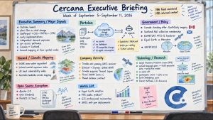
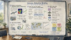
Cercana Executive Briefing: Week of June 20 – 26, 2026

162 feeds monitored. Published June 26, 2026.

Executive Summary

The defining development of the week is an emerging analytical consensus, backed by commercial milestones, that satellite intelligence is crossing into a new commercial phase. SAR and thermal infrared data are not simply improving. They are moving from specialized geospatial products toward pricing-grade evidence for financial and operational decision-making. Project Geospatial published two rigorous analytical pieces making that case directly. Synspective’s announcement that it became the first commercial SAR provider to achieve global CEOS-ARD certification gives that shift institutional weight. BAE Systems’ contract to build Vantor’s 20 cm Vantage satellites provides the hardware layer. These are not routine vendor announcements. For executives in risk, finance, and operations, the implication is that EO data is becoming more usable in procurement, underwriting, and investment workflows.

Running in parallel, Bill Dollins, President of Cercana Systems, wrote three pieces at geoMusings arguing that AI is selectively eroding the “soft middle” of the geospatial software market: the bounded, expensive-but-shallow tools now within reach of AI emulation. The data layer is becoming harder to displace while parts of the software layer are becoming easier to replicate. For executives, the immediate question is whether their position is anchored in data, workflow depth, or feature bundles that are now easier to imitate.

On the platform side, Esri’s coordinated June 2026 release wave, more than 20 blog posts in 48 hours timed to the User Conference, signals an aggressive bet on platform depth as the defensible position against AI-native alternatives. The open-source world produced quieter but still meaningful developments. PostGIS decoupled its Tiger Geocoder, and STAC announced its first Japan community gathering at JAXA. The implication is that both proprietary and open ecosystems are reinforcing infrastructure, integration, and standards rather than competing on AI features alone.

Major Market Signals

Satellite Intelligence Becoming Financial Infrastructure

This week brought a strong case that commercial EO data, specifically SAR and thermal infrared, is moving from a niche geospatial asset to a pricing-grade financial signal. Project Geospatial’s “SAR in the AI Era” argues that AI is transforming synthetic aperture radar from a military-grade sensor into a scalable engine for commercial risk pricing, persistent asset monitoring, and sovereign intelligence. The companion piece, “The Thermal Economy,” makes an analogous case for satellite infrared: every economic act of energy conversion leaves a thermal signature, and that signature is now being monetized as a financial input for energy markets, industrial monitoring, and supply chain intelligence. These analytical arguments are structural rather than promotional, and they arrived in the same week Synspective achieved global CEOS-ARD certification, making it the first commercial SAR provider to meet the standardized data-quality threshold institutional and governmental buyers require before integrating EO data into financial workflows. The commercial EO market is moving beyond a simple “better imagery” argument and toward infrastructure-grade use in financial and operational workflows.

GeoAI Eroding the Soft Middle of the Geospatial Software Market

Bill Dollins, President of Cercana Systems, wrote three pieces this week on AI’s uneven pressure across the geospatial software market. “GeoAI and the Soft Middle of the Geospatial Market” argues that AI disruption is not applying evenly across geospatial software. The exposed zone is mid-market products that are expensive enough to prompt scrutiny when AI alternatives emerge, bounded enough in function to be cleanly emulated, and shallow enough in integrations that rebuilding them would not be prohibitive. Tools with deep enterprise workflow integration, dominant platform lock-in, or broad ecosystem dependencies remain relatively protected. “Vibe Coding, AI Disruption, and the Restructuring of the SaaS Market” maps this to the broader software economy. “Interpretation and Ownership” uses the classic Fitts HABA-MABA framework, humans are better at interpretation, machines are better at throughput, to argue that the real question in AI deployment is not capability but accountability: who owns the interpretation, and who bears the consequences when it is wrong. The three pieces point to where AI pressure is likely to concentrate in the geospatial software market.

Esri’s Platform Escalation Into Cloud-Native, 3D, and AI

Esri published more than 20 ArcGIS blog posts on Thursday and Friday in a clearly coordinated wave timed to the 2026 User Conference. The key updates include Parquet feature layers in beta in ArcGIS Online, bringing cloud-native columnar data access into the platform’s mainstream; Mapillary Global Street-level Imagery integration in beta; Google Photorealistic 3D Basemap availability in ArcGIS Online and ArcGIS Pro; June 2026 updates to AI assistants; ArcGIS Enterprise 12.1 on Kubernetes; and ArcGIS for ServiceNow, which bridges spatial data into enterprise IT workflows. Esri is competing on platform integration depth rather than any single AI capability. The volume and coordination of the release wave appears designed to demonstrate ecosystem breadth at precisely the moment AI-native geospatial alternatives are gaining visible momentum.

EO Resolution Race and Data Standards Converge

The commercial EO market is being reshaped simultaneously by a hardware race and a standards race, and this week both moved. BAE Systems confirmed it will build Vantor’s Vantage constellation at 20 cm resolution, with reduced latency and higher collection frequency as explicit design goals. Those specifications are driven by commercial financial and rapid-response use cases rather than traditional government imagery requirements. Synspective’s CEOS-ARD certification establishes a different kind of competitive bar: resolution is only commercially useful to institutional buyers if the data meets audit-grade quality standards. The first commercial SAR provider to clear this threshold sets a benchmark other providers will face pressure to match, particularly for government procurement and risk-market integration. EarthDaily’s piece on science-grade data-quality frameworks reinforces that this is a sector-wide conversation rather than a single vendor’s marketing claim.

Open-Source Infrastructure Modularizing and Globalizing

Two developments in the open-source ecosystem deserve attention despite their technical appearance. PostGIS published Tiger Geocoder 2025.1 as a fully standalone extension, the first release fully decoupled from the PostGIS core package. This is more than a routine point release. It marks a modularization of the PostGIS ecosystem, reduces coupling risk for downstream deployments, and creates independent maintenance paths for component teams. PostGIS is following a familiar pattern for mature open-source ecosystems by modularizing at scale. Separately, the Cloud Native Geo Foundation announced STAC Japan 2026 at JAXA’s Tsukuba Space Center, the first STAC community gathering in Japan, colocated with a national space agency. STAC’s expansion into Asia-Pacific at the government level is different from a conference-track signal. It suggests that cloud-native EO data standards are being adopted as national infrastructure rather than only commercial tooling.

Notable Company Activity

Product Releases

  • Esri: June 2026 platform wave across ArcGIS Online, ArcGIS Pro, and ArcGIS Enterprise. Key launches include Parquet feature layers in beta in ArcGIS Online, Google Photorealistic 3D Basemap integration, Mapillary Global Street-level Imagery in beta, ArcGIS Enterprise 12.1 on Kubernetes, ArcGIS Maps SDK for JavaScript 5.1, StoryMaps Frames for mobile-first storytelling, and ArcGIS for ServiceNow. AI assistants and core products including Map Viewer, Scene Viewer, Dashboards, Velocity, and GeoBIM also received June updates.
  • PostGIS: Tiger Geocoder 2025.1 released as the first fully standalone extension, decoupled from PostGIS 3.6+. Requires PostgreSQL 16 and above and is compatible with any supported PostGIS version.
  • Oslandia: CityForge v1.2.1 released, with updates to the open-source 3D city model management platform.

Partnerships

  • BAE Systems and Vantor: BAE Systems contracted to design and build the Vantage constellation, a 20 cm resolution EO satellite system for Vantor designed to reduce latency and increase imagery collection density for commercial markets.

Government and Policy Developments

The OGC London Code Sprint this week advanced standards work across three active areas: GIMI (Geospatial Information Management and Interoperability), GeoSciML for geological data sharing, and 3D geospatial workflow interoperability. The 3D strand stands out because it is actively bridging the geospatial and BIM communities, and the parallel Esri GeoBIM updates this week suggest commercial platform development is tracking standards progress in real-time. Standards work moving alongside commercial product development is usually a sign of a maturing market.

Synspective’s CEOS-ARD certification carries policy dimensions beyond the commercial market. Analysis Ready Data standards are increasingly embedded in government and multilateral procurement requirements, particularly for national spatial data programs and development-sector applications. The first commercial SAR provider to clear this bar changes the procurement calculus for any national agency evaluating commercial SAR acquisition. The procurement question becomes less about whether the data can be used and more about which certified provider should be chosen.

In Australia, a new state-based geospatial body launched, and the Tasmanian Spatial Information Council joined TasICT, reflecting ongoing growth in the state-level spatial governance layer. The FIG Working Week in Cape Town, covered by Spatial Source this week, surfaced global surveying community priorities in land administration and urban boundary management, an area where boundary disputes are reportedly rising in Australian cities due to densification pressures.

Technology and Research Trends

Two analytical frameworks published this week offer executives a useful lens for evaluating their own data strategies. The Project Geospatial pieces on SAR as financial infrastructure and thermal as financial signal are, in effect, market-design arguments. Geospatial data delivers maximum commercial value when it is standardized, continuous, cloud-native, and tied to a priced risk or operational outcome. This reframes the product design philosophy for commercial EO from “better imagery yields better analysis” to “certified, machine-readable data enables automated financial workflows.” That is a different value chain, and it implies different product roadmaps.

On the tooling side, EarthLens, a project described this week on Medium, translates plain-English prompts into satellite map queries built on Google Earth Engine, representing an early but visible convergence of natural-language interfaces and EO analysis pipelines. A companion piece on streaming SAR imagery from STAC APIs identifies what it calls the “catalog visibility problem”: despite more satellites and more data, discoverable streaming access remains friction-heavy. These pieces suggest that discoverability and usability, rather than data availability, are becoming a more immediate competitive battleground in commercial EO.

Research activity continues at the intersection of remote sensing and structural risk. DLR researchers presented AI-based earthquake risk modeling at the GEM Conference, and The Spatial Edge published a piece on multi-source geospatial approaches to building-level damage prediction. These represent applied convergence of EO, AI, and physical risk modeling, directly relevant to the insurance and resilience sectors now being addressed by the thermal and SAR financial-infrastructure argument.

Open Source Ecosystem Signals

The PostGIS Tiger Geocoder 2025.1 release stands out among this week’s open-source developments. The geocoder extension’s decoupling from the PostGIS core, with PostGIS 3.6 the last series to include it as a bundled component, marks a modularization pattern that reflects ecosystem scale. Large, mature open-source projects tend to decompose into independently versioned components when they outgrow monolithic release cycles. It allows the geocoder team to iterate on U.S. address standardization data, the underlying TIGER census datasets, without coupling those releases to PostGIS core database-engine changes.

FOSS4G North America 2026 published a community framing piece ahead of the event, explicitly emphasizing the social infrastructure of governance, contribution culture, and volunteer sustainability behind the tools. This framing suggests that the community is investing in long-term health rather than only feature velocity, a point worth noting for enterprises and governments depending on open-source geospatial infrastructure.

The STAC Japan 2026 announcement at JAXA’s Tsukuba Space Center is the clearest ecosystem signal in this section. The first STAC community gathering in Japan, hosted by a national space agency over three days, is not a conference track. It is a national-level standards adoption event. Executives evaluating cloud-native EO data architectures should note that STAC is now being adopted at the government infrastructure level in Asia-Pacific, which strengthens the case for STAC-compliant pipelines in global deployments.

Oslandia published a writeup on QGIS’s 3D capabilities, consistent with 3D momentum visible across the week in Esri’s Scene Viewer updates, OGC’s 3D standards sprint, and CityForge’s v1.2.1 release.

Watch List

  • EarthLens and the NL-to-EO pipeline: Natural-language-to-Earth-Engine query interfaces remain in the early developer-experiment phase. The first production-grade deployment in this category would materially lower the barrier to EO analysis for non-technical users. Watch for uptake in the public sector and NGO space, where Google Earth Engine is already dominant.
  • STAC Japan 2026 / Asia-Pacific cloud-native adoption: The August event at JAXA’s Tsukuba Space Center is the leading indicator. Announcements of national STAC catalog implementations in Japan, South Korea, or Australia in Q3 would confirm the globalization of cloud-native EO standards at government scale.
  • AI’s Geography Problem: A piece published this week by the Place data trust argues that AI models have systematic geographic biases rooted in uneven training data, performing differently across geographies in ways that are rarely disclosed. As GeoAI products proliferate in planning, insurance, and public sector applications, this bias issue has procurement and regulatory implications that have not yet surfaced in standards or contract language.
  • Space Infrastructure as a Service: A Geospatial World Forum 2026 session on SpaceIaaS, enriching geospatial platforms with space infrastructure as a managed service, hints at an emerging commercial model beyond satellite data licensing. Worth monitoring for product announcements in H2.
  • Climate MGA Scaling: Clairvoyint AI’s piece on what climate managing general agents need to scale identifies geospatial data as a core underwriting input that existing MGA infrastructure is not designed to consume at operational speed. This is a recurring weak signal in the insurance-geospatial intersection that is slowly converging toward a visible market.

Top Posts of the Week

Disclosure: Bill Dollins, author of items 3 and 4 below, is President of Cercana Systems.

  1. SAR in the AI Era: Why All-Weather Satellite Intelligence Is Becoming Financial InfrastructureGeospatial Frontiers, Project Geospatial – Argues that AI is repositioning SAR from a niche sensor to commercial risk-pricing and sovereign-intelligence infrastructure.
  2. The Thermal Economy: The Financial Value of the Emerging Satellite Infrared EcosystemGeospatial Frontiers, Project Geospatial – A companion piece making the parallel financial-infrastructure argument for satellite thermal data, with analysis of the economic sectors being penetrated.
  3. GeoAI and the Soft Middle of the Geospatial MarketgeoMusings by Bill Dollins – Argues that AI pressure is concentrating in mid-market geospatial tools with bounded function and relatively shallow integrations.
  4. Interpretation and OwnershipgeoMusings by Bill Dollins – Uses the Fitts HABA-MABA framework to examine accountability in AI deployment: who owns the interpretation, and who bears the consequences.
  5. Synspective Becomes First Commercial SAR Provider to Achieve Global CEOS-ARD CertificationGeoconnexion – Reports a data-quality milestone with implications for commercial SAR competition and government and financial procurement.

Cercana Executive Briefing is generated from 162 feeds aggregated by geofeeds.me.

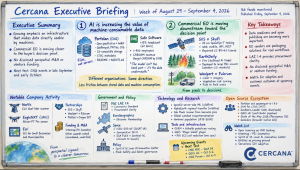
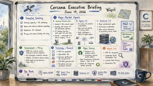
Cercana Executive Briefing: Week of June 13 – June 19, 2026

162 feeds monitored. Published June 19, 2026.

Executive Summary

Geospatial market activity this week reflects the interaction between expanded sensing capacity and AI systems that operate that capacity with increasing autonomy. Three space-based milestones landed on Thursday: the Sentinel-1 next-generation SAR contract was signed, HawkEye 360’s Cluster 14 reached full operational capacity for signals intelligence, and SI Imaging Services closed a multi-year Sat-aaS agreement. Vexcel extended the same pattern into airborne collection with a nationwide U.S. aerial imagery program at 7.5cm resolution.

The collection layer is becoming more dynamic. Project Geospatial’s analysis of “agentic GEOINT” describes AI moving upstream into sensing orchestration, where systems determine collection targets and timing. That design direction is visible across both commercial and defense operators.

GeoServer 3.0 shipped this week after a community crowdfunding effort. The release arrives as sovereignty directives, procurement pressure, and cloud-native modernization reshape enterprise geospatial infrastructure. GEO Business 2026 drew 6,200 attendees and Digital Construction Week drew 9,000, indicating continued market expansion around these themes.

Two developments introduce structural exposure. A proposed OMB rule would tie U.S. federal science funding to political alignment, affecting Earth observation and environmental monitoring programs. Location data privacy is also moving toward a regulatory posture that reflects the limits of anonymization and the portability of jurisdictional risk.


Major Market Signals

Sensing Infrastructure Investment Is Expanding Across Space and Airborne Platforms

Three sensing milestones arrived within a single 24-hour window: the Sentinel-1 next-generation SAR contract was signed, HawkEye 360 reached full operational capacity on its Cluster 14 signals intelligence constellation, and SI Imaging Services closed a multi-year Sat-aaS agreement for 25cm SpaceEye-T imagery. Vexcel’s nationwide U.S. aerial imagery program at 7.5cm resolution, with collection beginning in January 2027, extends the same investment pattern to airborne platforms.

Poland’s CAMILA initiative and continued development of second-generation Galileo add evidence of national and regional investment in sovereign geospatial infrastructure. The supply environment for imagery and SIGINT is expanding. Analytics vendors face a different constraint, which is the ability to process and act on increased data volume rather than access to data itself.

Agentic AI Is Entering the Collection Layer

Project Geospatial’s “Agentic GEOINT” analysis describes a shift from post-processing analytics toward autonomous orchestration of satellite collection. AI agents respond to triggers and direct sensing resources in near real time rather than relying on manual tasking.

Cambridge University’s Earth Intelligence tool and a growing set of QGIS AI agent plugins point in the same direction across commercial, academic, and practitioner environments. The operational boundary between collection and analysis is becoming less distinct.

GeoServer 3.0 Reshapes the Enterprise Web Services Landscape

GeoServer 3.0 was released after more than a year of development and a community crowdfunding campaign. It represents a substantial architectural update and positions GeoServer as an enterprise-grade alternative to proprietary mapping server platforms.

The release aligns with sovereignty directives, cost pressure, and modernization programs that are driving evaluation of vendor lock-in. The crowdfunding model reflects direct enterprise participation in upstream open-source development. Government adoption in Europe and continued enterprise evaluation of migrations away from proprietary server stacks are likely to follow. FOSS4G NA reinforced this direction through deployments focused on wildfire preparedness.

Notable Company Activity

Product Releases

  • Vexcel: Announced the first nationwide U.S. aerial imagery program at 7.5cm resolution, with collection starting in January 2027. The program establishes a new commercial baseline for national coverage density, with downstream implications for insurance, infrastructure, and urban analytics.
  • FEMA: Released Hazus v7.2, moving the disaster loss estimation platform to an ArcGIS Pro-based version and affecting the government agencies, emergency managers, and insurance actuaries that depend on it.
  • Soar Atlas: Launched a 3D Mode Beta that converts 2D geospatial datasets into browser-based 3D visualization, making it a watch-list item for the web-native 3D stack.
  • MapTiler: Released geocoding controls for JavaScript maps without a Svelte dependency, reducing developer friction.

Partnerships

  • Topcon × Pix4D: Announced a collaboration targeting the utilities sector’s data fragmentation problem across energy, water, and communications infrastructure workflows.

Funding & M&A

  • Hexagon acquires ITRES: Hexagon AB acquired Calgary-based ITRES Research, a provider of airborne hyperspectral and thermal imaging systems. The acquisition adds spectral sensing capability relevant to precision agriculture, environmental monitoring, and infrastructure inspection.
  • SI Imaging Services: Closed a multi-year Sat-aaS deal in the double-digit millions for 25cm SpaceEye-T imagery delivery to an undisclosed international customer.

Government and Policy Developments

The sharpest U.S. policy signal this week came from Public Environmental Data Partners: a proposed OMB rule would make political alignment a prerequisite for federal science funding, directly exposing atmospheric monitoring, climate-related Earth observation programs, and environmental data collection to a political filter. Separately, NSF reversed course on deep-sea monitoring following bipartisan congressional intervention. That reversal was a limited win, showing that specific scientific programs retain political defensibility when organized advocacy intervenes. It does not resolve the underlying structural risk to U.S. geospatial research funding.

European sovereignty investment continued on parallel tracks. The Sentinel-1 NG contract was signed; Poland’s CAMILA initiative, the country’s largest domestic satellite program, secured GMV as control system developer with ESA involvement; and second-generation Galileo development advanced with the addition of inter-satellite radio links. Each program reflects a consistent EU and member-state posture: space-based geospatial infrastructure is treated as sovereign capability, not merely procured service.

In Australia and New Zealand, ANZLIC articulated a maturing government posture: the conversation has shifted “from data to decision-making.” NSW will mandate digital form submission for surveyors beginning July 1. New Zealand’s Otago Regional Council received NZ$529,000 in additional funding to complete a 3D LiDAR program through 2027–28, and a New Zealand-led GNSS reflectometry effort is advancing toward near-real-time soil moisture monitoring for agriculture.

Technology and Research Trends

The expansion of MCP, or Model Context Protocol, into geospatial tooling defines a key infrastructure shift. VerySpatial’s Episode 787 highlighted this alongside the general availability of SpatialSQL. MCP provides standardized interfaces for AI agents to interact with spatial databases, APIs, and processing pipelines, enabling coordinated workflows across systems.

Gaussian splatting entered the geospatial discussion through the VerySpatial podcast. The technique produces photorealistic 3D scene reconstructions from image sequences and is being applied to site mapping, urban modeling, and inspection. GWF 2026 plenary sessions on digital twins and GeoAI for utilities indicate movement from pilot programs toward operational deployment.

The Spatial Edge newsletter highlighted COP-GEN, a generative Earth observation model that produces synthetic imagery with physical consistency. This approach affects training data generation and simulation workflows. Research on permafrost degradation and mass movement potential is reaching a level of spatial granularity that aligns with actuarial modeling timelines.

Open Source Ecosystem Signals

GeoServer 3.0.0 is the headline open-source development of the week. Development Seed also published a mapping of its contributor network, a revealing exercise that surfaces the depth of interdependence across the geospatial open-source stack. For enterprise procurement teams doing open-source due diligence, contributor network health is becoming a standard evaluation criterion.

The Open Visualization Collaborator Summit 2026 has been announced for September 9–10, bringing together the vis.gl, deck.gl, and OpenVisualization communities to set the roadmap for the open-source geospatial visualization stack. FOSS4G NA continued building its pre-conference profile, this week focused on wildfire preparedness tooling. Oslandia hosted an open-source GIS thematic day in Tours and published an open-source 3D geotechnical case study. The QGIS ecosystem is also generating notable AI integration content, including NASA OPERA plugins with AI agents, satellite timelapse tools, and an integrated terminal plugin.

Watch List

  • MCP for Geospatial: Model Context Protocol expansion into spatial tooling continues to progress. Standardized interfaces for AI agents to access spatial systems enable coordinated workflows across data, APIs, and processing pipelines.
  • Cambridge Earth Intelligence Tool: Trade press coverage lacks technical detail. Further disclosure would clarify whether the system represents a foundation-model approach to Earth observation interpretation.
  • Location Data Privacy: Regulatory attention is increasing as re-identification remains feasible with high-resolution mobility data. European policy direction continues to develop in this area.
  • COP-GEN and Generative EO: Generative models that produce physically consistent Earth observation imagery are advancing toward applied use in training and simulation contexts.

Top Posts of the Week

  1. “Agentic” GEOINT: The Autonomous Shift in Satellite Collection Orchestration — Geospatial Frontiers / Project Geospatial — June 15, 2026 — Examines the shift toward AI systems directing satellite collection in response to real-time triggers, with implications for how sensing assets are tasked and coordinated.
  2. Vexcel Announces the First Nationwide U.S. Aerial Imagery Program at 7.5cm Resolution — Geo Week News — June 15, 2026 — Establishes a new commercial baseline for nationwide imagery density, with downstream effects across insurance, infrastructure, and urban analytics workflows.
  3. GeoServer 3.0: la mayor modernización de la plataforma en años — MappingGIS — June 16, 2026 — Details the architectural overhaul in GeoServer 3.0 and the implications for enterprise deployment, scalability, and alternatives to proprietary server platforms.
  4. Why Location Data Privacy Is a Geospatial Problem — Geo Week News — June 18, 2026 — Frames privacy risk as inherent to the spatial resolution and structure of location data, where re-identification remains feasible under standard anonymization approaches.
  5. AI Data Centers and the Risk of Stranded Infrastructure — geoMusings — June 15, 2026 — Explores how shifts in AI workload composition and efficiency may change assumptions about data center demand, affecting infrastructure siting and investment decisions.

Cercana Executive Briefing is produced from 162 feeds aggregated via geofeeds.me.

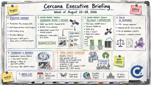
Cercana Executive Briefing — Week of April 25–May 1, 2026

153 feeds monitored. Published May 1, 2026.

Executive Summary

Two themes defined this week, and they reinforce each other in ways that deserve executive attention. The first is vendor consolidation. VertiGIS’s £87 million acquisition of 1Spatial marks the largest geospatial M&A event in recent months, combining enterprise data quality with location intelligence in a deal explicitly framed around the next wave of AI-powered geospatial networks. The second is the accelerating reconceptualization of geospatial from a mapping function to decision infrastructure. GoGeomatics’s interview with Nadine Alameh ahead of GeoIgnite 2026 and a Reimagining Geospatial post on “Earth models” both articulate the same thesis from different angles: the industry is moving from maps to autonomous decision loops, with geospatial foundation models as the enabling architecture.

These two threads, consolidation around data quality and the rise of AI decision infrastructure, are not coincidental. As the stakes of spatial AI outputs grow, the demand for accurate, authoritative, well-governed base data grows with it. The VertiGIS/1Spatial deal is, in part, a bet on exactly that premise.

Alongside these, FedGeoDay 2026 surfaced a distinct and important development: the U.S. federal government is treating geospatial data preservation as a national security priority, not merely an archival task. Combined with Bentley Systems achieving FedRAMP authorization for its infrastructure digital twin platforms, the government market is quietly but consistently hardening its geospatial data infrastructure. Leaders should watch this track closely because it is where procurement follows strategic intent.

Major Market Signals

Enterprise Consolidation Accelerates Around Data Quality and Location Intelligence

The VertiGIS acquisition of 1Spatial, a £87 million take-private deal announced Thursday, is the clearest indication yet that the upper tier of enterprise geospatial is consolidating around the convergence of data quality, governance, and AI-ready infrastructure. VertiGIS, best known for its GIS application platforms built on Esri and open-source stacks, is acquiring 1Spatial’s global data quality and management business. The combined entity positions itself to serve the data quality demands that AI-driven geospatial workflows expose at scale. For executives, the implication is straightforward: when AI systems ingest spatial data for automated decisions, bad data quality has operational consequences, not just analytical ones. The deal suggests that the market recognizes this and that vendors are racing to own the quality layer before their customers demand it as a commodity.

Geospatial Reframes From Mapping to Decision Infrastructure

Two independent posts this week articulate what may become the defining strategic narrative of 2026: geospatial is ceasing to be a visualization and analysis tool and becoming the substrate for autonomous decision-making. Nadine Alameh’s GeoIgnite 2026 preview interview frames natural language interfaces and GeoAI as enabling “decision loops,” or systems that act on spatial intelligence rather than merely displaying it. At the same time, Reimagining Geospatial published a structural analysis of “Earth models” that asks whether the industry will produce one comprehensive geospatial foundation model or a proliferation of vertical-specific models. These are not theoretical discussions. They define the architecture of geospatial AI investment for the next three years. The convergence of two independent voices on this idea in a single week suggests the market’s mental model is shifting.

U.S. Federal Geospatial: From Access to Resilience

FedGeoDay 2026, held at the U.S. Census Bureau in Suitland, Maryland, drew coverage from two independent observers this week. Both noted a pronounced shift in the event’s thematic focus toward data preservation and federal data stewardship. The opening keynote by Denice Ross anchored a program explicitly oriented around what happens to geospatial data assets when agencies are restructured or defunded. Separately, Bentley Systems announced FedRAMP authorization for ProjectWise and OpenGround, enabling federal agencies to deploy its infrastructure digital twin environment in compliant cloud settings. Taken together, these developments reflect a federal geospatial market that is less focused on new capability acquisition and more focused on fortifying the data and software infrastructure it already has. That posture shift has direct implications for government contract strategy.

Satellite-Based Predictive Analytics Expands Into Commodity Markets

Geospatial FM’s profile of QuantAgri, a startup using satellite data to predict USDA’s monthly WASDE agricultural supply and demand reports, illustrates a market trajectory worth tracking: the commercialization of EO analytics as a financial edge tool in commodity trading. This use case, satellite-derived crop intelligence feeding into trading models, represents a premium, high-margin vertical that bypasses traditional government or enterprise procurement cycles. It also highlights a useful counterpoint to Bill Dollins’s essay this week, discussed in the Technology section, which argues that satellite data has genuine blind spots in tracking industrial infrastructure transitions. Both point to a maturing EO market in which buyers are becoming sophisticated enough to understand where satellite analytics delivers alpha and where it does not.

Notable Company Activity

Funding and M&A

  • VertiGIS × 1Spatial: VertiGIS completed a £87 million take-private acquisition of 1Spatial, combining VertiGIS’s enterprise GIS application platform with 1Spatial’s geospatial data quality, governance, and management capabilities. The deal is framed around delivering AI-ready spatial data infrastructure for network operators, utilities, and government customers globally.
  • Spaceflux: London-based space situational awareness company Spaceflux raised a £3.5 million extension to its seed round, bringing total funding to £9 million. The capital will fund global expansion of its space intelligence platform, which tracks objects and activity in Earth orbit for commercial and government customers.

Product Releases

  • Esri, ArcGIS GeoEvent Server Deprecation: Esri announced the formal deprecation of ArcGIS GeoEvent Server, its legacy real-time event processing product. The deprecation points to Esri’s strategic migration of real-time geospatial capabilities to cloud-native and ArcGIS Velocity-based workflows. This is a meaningful architecture shift for enterprise customers running real-time IoT or sensor pipelines.
  • Bentley Systems, FedRAMP Authorization: Bentley Systems achieved FedRAMP authorization for ProjectWise, its connected data environment, and OpenGround, its subsurface data management product. The authorization clears the path for U.S. federal agencies to use Bentley’s infrastructure digital twin platform in regulated cloud environments.

Partnerships

  • HTX × ST Engineering, Singapore: Singapore’s Home Team Science & Technology Agency and ST Engineering announced a new space technology program targeting enhanced public safety operations. The partnership is an early indicator of Asia-Pacific government demand for integrated space-derived intelligence in domestic security applications.

Government and Policy Developments

FedGeoDay 2026 was the week’s most substantive government development. Two independent observers, Bill Dollins at geoMusings and the Project Geospatial team, both covered the event and noted that the program was organized around a thematic spine of data preservation and federal stewardship. The practical implication is clear: U.S. federal geospatial strategy is currently oriented around protecting and maintaining existing spatial data assets rather than expanding capabilities, a direct response to the fiscal and organizational pressures on civilian agencies. For vendors, this is a shift from sell-new to maintain-and-secure, with procurement conversations centering on data resilience and continuity rather than feature expansion.

Bentley Systems’ FedRAMP announcement is a complementary development. ProjectWise and OpenGround joining the FedRAMP authorized list removes a key procurement barrier for federal infrastructure agencies, particularly those managing the Biden-era infrastructure buildout assets now operating under the current administration’s scrutiny. Compliance certification is not glamorous, but in the federal market it is the precondition for revenue.

The ISPRS Congress announcement, with the XXV International Society for Photogrammetry and Remote Sensing Congress returning to Canada for the first time in decades and co-locating with the 47th Canadian Symposium on Remote Sensing, points to the continued elevation of Canada as a geospatial industry hub. GeoIgnite 2026 in Ottawa, scheduled for May 11–13, adds to this picture. For executives with North American government or academic portfolios, the Canadian geospatial market warrants closer attention this year.

Technology and Research Trends

The week’s most thought-provoking analytical piece came from Bill Dollins at geoMusings: “What Spatial Finance Cannot See From Orbit.” Using the premature retirement of a Maryland coal plant as a case study, Dollins argues that satellite imagery and EO-derived spatial finance tools systematically undercount the pace of industrial infrastructure transitions because the physical footprint of a plant does not change when its operations cease. This is a calibration argument, not a dismissal. EO data is a leading indicator in some contexts and a lagging one in others, and sophisticated buyers are increasingly capable of distinguishing between them. For the spatial finance market, this piece functions as a market maturation marker. The buyers are getting smarter.

The Earth models debate, articulated in Reimagining Geospatial’s “Autonomous Flying Cars and Geospatial Earth Models,” raises a structural architecture question that will have vendor strategy implications for the next 24 months. The author’s position that specialized vertical models are more likely to prevail over a single monolithic Earth model aligns with the general direction of AI development across other domains. If correct, it suggests that geospatial AI value will accrue to domain-specific applications, such as agriculture, infrastructure, and emergency management, rather than to general-purpose foundation model providers. This has direct implications for how executives should evaluate GeoAI platform investments.

ECOSTRESS land surface temperature data is emerging as a serious tool for characterizing active wildfire behavior in near real time, a trend documented this week in EarthStuff’s coverage of a new peer-reviewed application. Separately, Spatial Source reported on a multi-sensor approach combining GIS, LiDAR, and AI for high-resolution tree cover loss monitoring. Both developments show continued momentum in applied EO analytics for environmental monitoring use cases, where government and insurance market demand is growing.

Open Source Ecosystem Signals

GDAL v3.12.4 shipped this week, a maintenance release noted by the #geoObserver feed. While not a feature release, the cadence of GDAL maintenance updates matters. GDAL underpins virtually every geospatial pipeline in production, and the continued pace of patch releases reflects healthy core maintainer activity. Organizations evaluating the health of their open-source dependencies should track GDAL maintenance velocity as a baseline indicator.

Esri’s deprecation of ArcGIS GeoEvent Server has indirect open-source implications. Organizations running real-time geospatial pipelines on GeoEvent Server that are unwilling or unable to migrate to Esri’s cloud-native replacement may look to open-source alternatives, such as Apache Kafka with spatial extensions or GeoServer’s OGC API Features real-time implementations, as migration paths. Esri’s deprecation decision creates a procurement opening that open-source stack integrators should consider.

Mapscaping’s large-scale publication this week of state-by-state public data maps, including PFAS contamination, wind turbines, EV charging stations, power plants, and storm reports, is a notable content and SEO play rather than a product announcement. It also points to growing commercial appetite for localized, authoritative public-data visualizations as a discovery and lead-generation tool. The underlying data layers are open. The differentiation is in packaging and accessibility.

Watch List

  • Space Situational Awareness as a Commercial Market: Spaceflux’s £9M raise and Singapore’s HTX/ST Engineering space program both appeared in the same week. The commercial SSA market, which tracks orbital objects and activity, is attracting sustained capital and government partnership attention outside the traditional defense procurement path.
  • GeoAI Vocabulary Hardening: The phrase “decision loop” appears in the Alameh interview, while “Earth models” anchors the Reimagining Geospatial piece. When independent voices begin converging on the same vocabulary, vendor positioning language often follows. Watch for these terms in product announcements over the next 60 days.
  • Satellite-Derived Commodity Trading Intelligence: QuantAgri’s EO-to-WASDE prediction model represents a thin edge of a market, satellite analytics sold into commodity trading workflows, that is distinct from enterprise GIS and worth monitoring for funding activity.
  • Canadian Geospatial Market Elevation: GeoIgnite 2026, scheduled for May 11–13 in Ottawa, and the ISPRS Congress announcement position Canada as an unusually active geospatial hub this cycle. Executive attention and vendor investment may follow.
  • Foursquare Conversational API: Foursquare published an internal post this week on testing methodology for its conversational location API. This is a sign that production-grade natural language location interfaces may be closer to deployment than they appear in public announcements.

Top Posts of the Week

  1. VertiGIS acquires 1Spatial: Discover what this means for geospatial customers, products, and the industry, VertiGIS Blog. The definitive primary source on the week’s largest M&A transaction, framing the deal as an AI-readiness play for geospatial data quality at scale.
  2. FedGeoDay 2026: Four Talks Worth Your Attention, geoMusings by Bill Dollins. A substantive summary of FedGeoDay’s data-preservation-focused agenda and the most direct window into current U.S. federal geospatial strategy.
  3. From Maps to Decision Loops: Nadine Alameh on Rethinking Geospatial in the Age of AI, GoGeomatics. A pre-GeoIgnite interview articulating the “decision loop” framing for GeoAI that is gaining traction as the industry’s organizing narrative for 2026.
  4. What Spatial Finance Cannot See From Orbit, geoMusings by Bill Dollins. A rigorous critical analysis of EO data’s blind spots in spatial finance applications, essential reading for anyone pricing or purchasing satellite-derived analytics.
  5. Autonomous Flying Cars and Geospatial Earth Models, Reimagining Geospatial. A structural analysis of the monolithic-versus-specialized Earth model debate, with direct implications for how executives should evaluate geospatial AI platform bets over the next two years.

Cercana Executive Briefing is generated from 153 feeds aggregated by geofeeds.me.
Three Geospatial AI Myths Federal Buyers Should Not Believe

April Fools’ Day is as good a time as any to talk about geospatial AI, because there is still a surprising amount of wishful thinking in the market.

Some of it is harmless marketing shorthand. Some of it is not. For federal buyers, the difference matters. Procurement decisions made on inflated claims can leave agencies with brittle systems, poor data quality, and very expensive disappointment.

So, in the spirit of the day, here are three geospatial AI myths federal buyers should stop believing.

Myth 1: “AI will replace your GIS analysts”

It will not.

What AI can do, and increasingly does well, is accelerate parts of geospatial work that are repetitive, labor-intensive, or structurally well-bounded. That includes things like feature extraction from imagery, draft attribute population, metadata assistance, document entity extraction, semantic search, and automated QA/QC flagging for human review. Those are real gains, and they matter. They can make analysts faster, reduce backlog, and shift staff time toward higher-value work. But that is augmentation, not replacement (Pierdicca et al., 2025; Mansourian et al., 2024).

The part vendors often glide past is that geospatial work is rarely just data processing. It is judgment. It is fitness-for-use. It is understanding whether a dataset, workflow, or model output is actually suitable for a mission context. Federal geospatial programs do not succeed because someone can draw a polygon quickly. They succeed because someone knows whether that polygon should be trusted, how it was derived, what its limitations are, and what the consequences are if it is wrong.

That is why current federal AI policy still centers governance, risk management, testing, and monitoring rather than simple automation narratives. OMB’s current guidance requires agencies to manage risk in AI use cases, and its acquisition guidance emphasizes contract terms for ongoing testing and monitoring. NIST’s AI Risk Management Framework likewise treats validity, reliability, explainability, accountability, and transparency as core characteristics of trustworthy AI systems. More broadly, that emphasis is consistent with a longer-running federal concern that agencies need stronger governance around how data and technology are managed in practice, not just optimistic adoption narratives (National Institute of Standards and Technology, 2023; Office of Management and Budget, 2025a, 2025b; U.S. Government Accountability Office, 2020).

The practical question for federal buyers is not whether AI removes analysts. It is whether it makes analysts more effective without removing the controls that make their work defensible.

Ask vendors:

  • Where do humans stay in the loop?
  • What does analyst review look like in practice?
  • What happens when the model encounters unfamiliar data or edge cases?
  • What are the false positive and false negative rates?
  • Can the system be tested on our data before procurement?

If a vendor cannot answer those questions clearly, the “replacement” story is usually just a maturity problem wearing a marketing jacket.

Myth 2: “Our AI understands geography”

Usually, it does not. At least not in the way geospatial professionals mean it. Large language models can recognize place names, infer rough spatial relationships from training data, and produce plausible-sounding geographic language. That can be useful. They can help with geocoding workflows when paired with external validation, extract geographic entities from documents, generate natural-language descriptions of geospatial content, and route requests to the right tools. That is a meaningful capability. But it is not the same thing as spatial reasoning (Mansourian et al., 2024; Pierdicca et al., 2025).

Actual geospatial understanding requires more than knowing that Annapolis is in Maryland or that rivers flow downhill. It requires handling coordinate reference systems, projections, topology, scale, measurement, uncertainty, and the consequences of transforming data from one spatial framework into another. Those are not side issues. They are the work.

Recent research in LLM-enabled GIS is promising, but the stronger examples generally do not rely on a pure language model acting alone. They connect the model to external GIS tools, geospatial databases, scripted workflows, or validation layers. In other words, the most credible systems are not “the model understands geography.” They are “the model helps drive software that actually does geospatial work.”

Federal buyers should be very careful here, because this is where demo theater often flourishes. A chatbot that talks fluently about maps is not necessarily capable of performing sound spatial analysis. There is a large gap between linguistic confidence and geospatial competence.

Ask vendors:

  • Does the system rely on external geospatial databases and tools, or only on an LLM?
  • How does it handle coordinate transformations?
  • How does it deal with ambiguous place names?
  • What happens when topology, buffering, area, or network calculations are required?
  • Can you show the exact toolchain used for a spatial result?

If the answer is basically “trust the model,” that is not a geospatial AI strategy. That is a procurement warning sign.

Myth 3: “AI-generated geospatial data is production-ready”

Sometimes it is operationally useful. That is not the same thing as production-ready. AI-extracted features, auto-generated metadata, inferred attributes, and synthetic data can all play a useful role in geospatial workflows. But the word to keep in mind is assistive. These outputs can accelerate review, expand triage capacity, and help agencies focus expert attention where it matters most. What they should not do is bypass validation in mission-critical settings.

This is not an abstract concern. NIST frames trustworthy AI around validity, reliability, accountability, transparency, and explainability, all of which become especially important when outputs are used in operational or public-facing contexts. OMB’s acquisition guidance also points agencies toward contractual mechanisms for testing and monitoring over time, not just acceptance at delivery (National Institute of Standards and Technology, 2023; Office of Management and Budget, 2025b).

That matters because geospatial AI systems can produce outputs that look convincing while still being wrong. A computer vision model can miss features or invent them. Metadata generation can sound polished while omitting essential limitations. Synthetic attributes can appear statistically tidy while being operationally misleading. A confidence score can help, but only if there is a real workflow behind it that routes low-confidence or ambiguous outputs to human review.

This is where federal buyers should push hardest. Not on the happy path. On failure.

Ask vendors:

  • What validation workflow is included?
  • How do you measure and report accuracy?
  • Can we review incorrect output examples?
  • What happens at low confidence?
  • What kind of explainability is available to reviewers and auditors?
  • What monitoring exists after deployment?

A vendor who only wants to show perfect outputs is telling you less than they think.

What federal buyers should look for instead

The best geospatial AI vendors are usually the ones least interested in magic. They will show you where the model helps and where it does not. They will be explicit about toolchains, validation steps, and performance limitations. They will welcome testing on your data. They will talk about governance, monitoring, and human review without treating those things as inconvenient objections.

That posture aligns much better with where federal policy already is. Government guidance is not built around blind faith in AI. It is built around risk management, trustworthiness, accountability, and context-of-use. That is a much healthier frame for buying geospatial AI than the current crop of sweeping claims (National Institute of Standards and Technology, 2023; Office of Management and Budget, 2025a, 2025b).

So the simple rule is this: the vendors most confident in their systems should be willing to demonstrate them transparently on your data, discuss limitations openly, and show where humans remain essential.

If they will not, that is probably the most useful signal you are going to get.

For federal organizations trying to separate durable capability from AI theater, that evaluation work is becoming part of the job. It requires more than technical curiosity. It requires a clear view of mission fit, data readiness, governance, procurement risk, and where AI can actually improve operational outcomes. That is exactly the kind of problem strategic advisory and applied AI/ML support should help solve.

At Cercana Systems, this is the kind of work we help clients think through: where geospatial AI fits, where it does not, and how to evaluate, pilot, and implement it with a clear understanding of mission context and operational risk.

References

Office of Management and Budget. (2025a). Accelerating Federal Use of AI through Innovation, Governance, and Public Trust (M-25-21). Executive Office of the President.

Office of Management and Budget. (2025b). Driving Efficient Acquisition of Artificial Intelligence in Government (M-25-22). Executive Office of the President.

Mansourian, A., Pilesjö, P., Harrie, L., and others. (2024). ChatGeoAI: Enabling geospatial analysis for public through natural language, with large language models. ISPRS International Journal of Geo-Information, 13(10), 348.

National Institute of Standards and Technology. (2023). Artificial Intelligence Risk Management Framework (AI RMF 1.0) (NIST AI 100-1). U.S. Department of Commerce.

Pierdicca, R., Zingaretti, P., Frontoni, E., and others. (2025). On the use of LLMs for GIS-based spatial analysis. ISPRS International Journal of Geo-Information, 14(10), 401.

U.S. Government Accountability Office. (2020). Data governance: Agencies made progress in establishing governance, but need to address key milestones (GAO-21-152).

Cercana Executive Briefing — Week of March 14–20, 2026

Executive Summary

The clearest story this week is the way two separate announcements converge into a single market signal. NVIDIA introduced its first space-optimized AI computing module at GTC in San Jose. At nearly the same time, Planet Labs announced a GPU-native AI engine built on NVIDIA’s Blackwell and IGX Thor platforms. Taken together, these are more than routine product updates. They are a public indication that AI-accelerated geospatial intelligence is moving from experimentation into infrastructure.

Processing satellite imagery in seconds instead of hours, building planetary-scale vector embeddings for semantic search, and placing GPU hardware directly on satellites all point toward the same conclusion. This is becoming the new architecture of Earth observation.

That signal grew stronger this week as Google completed the global rollout of its AlphaEarth Foundations 2025 satellite embedding layer and demonstrated vector search integration across BigQuery and Earth Engine. This is a different path toward a very similar destination. When two major platforms move toward AI-native EO infrastructure at the same time, it is hard to dismiss it as coincidence. It looks much more like an inflection point.

At the same time, governments continued to build strategic distance from GNSS dependency. The United Kingdom released new funding to advance its National Timing Centre with atomic clock infrastructure as part of a broader multi-year program focused on sovereign PNT resilience. In the United States, the community-led HIFLD Next Commons launched to restore access to federal infrastructure datasets that were quietly shuttered in August.

The open-source side of the industry had its own important signal. QGIS launched one of its most coordinated sustainability pushes in recent memory, with a sustaining member campaign, a grants round, and a new flagship member all announced in the same week.

For decision-makers, the questions raised this week are fairly direct. Is your EO pipeline ready for GPU-native processing architectures? What is your exposure to GNSS dependency in critical operations? And if your work depends on U.S. public geospatial data, how much of it still rests on federal datasets that may no longer be reliably available?

Major Market Signals

GPU-Native EO Infrastructure Becomes the Production Standard

The most important structural development this week is the simultaneous move by NVIDIA and Planet Labs toward a GPU-native architecture for satellite imagery processing. NVIDIA launched its space computing platform at GTC, combining the IGX Thor and Jetson Orin modules into a system designed for size-, weight-, and power-constrained spacecraft environments. The company’s goal is explicit: bring data-center-class performance into orbit.

Jensen Huang put it simply: “intelligence must live wherever data is generated.” Planet, which operates the world’s largest Earth-observation constellation, said it will deploy NVIDIA hardware on its next-generation Pelican satellites and Owl constellation. The company also said this will reduce imagery processing from hours to seconds and allow it to apply NVIDIA’s CorrDiff generative AI diffusion model to produce physics-informed super-resolution imagery from its existing archive.

Planet also disclosed plans to convert its daily data stream into AI embeddings, making semantic search across global imagery possible at a new scale. Its stock rose by roughly 8% on the announcement, and the company also reported record Q4 revenue of $86.8 million, up 41% year over year. The market appears to be reading this not simply as a partnership announcement, but as a deeper shift in Planet’s model from imagery provider toward AI-native intelligence platform.

Other space companies, including Kepler, Aetherflux, Axiom Space, Capella, Sophia Space, and Starcloud, are also integrating NVIDIA platforms for orbital compute. That makes this look less like a one-off deal and more like an ecosystem shift.

Geospatial Foundation Models at Planetary Scale

The convergence between Planet and NVIDIA’s GPU-native processing strategy and Google’s AlphaEarth work points to a new baseline for EO analytics. Google completed its 2025 AlphaEarth Foundations satellite embedding update this week, delivering full global coverage at 10-meter resolution as a freely available dataset in Google Earth Engine and Cloud Storage.

The model compresses annual multi-sensor data, including Sentinel-2 optical, Sentinel-1 radar, Landsat thermal, GEDI LiDAR, climate models, and gravity fields, into 64-dimensional embeddings per pixel. That creates a practical foundation for similarity search, change detection, and downstream machine learning without requiring users to run their own deep learning inference stack.

Separately, a Google Earth blog post this week demonstrated embedding-based vector search across BigQuery, Earth Engine, and AlphaEarth Foundations. That is one of the clearest public signals yet of a unified semantic search pipeline for planetary data. For enterprise buyers, the significance is straightforward. A growing set of geospatial intelligence tasks, including similarity search, supply chain monitoring, and climate risk assessment, can increasingly be performed without deep remote sensing expertise or heavy infrastructure investment. That creates real pressure for traditional EO analytics vendors.

GNSS Sovereignty Investment Expands

A new funding release from the UK’s National Timing Centre program advanced construction of dedicated atomic clock infrastructure sites that will be connected through fiber and satellite to distribute a nationally assured timing signal independent of GPS or Galileo. The announcement, covered by Spatial Source this week, extends a multi-year UK investment program that now totals hundreds of millions of pounds across eLoran, atomic timing, GNSS interference monitoring, and space-based time transfer research and development.

The strategic framing is clear. Russian jamming and spoofing activity in and around conflict zones has demonstrated that GNSS-dependent critical infrastructure, including banking, telecommunications, energy, and transportation, carries an unacceptable single-point-of-failure risk. Australia is moving in a similar direction, with a reported $100 million CRC bid known as SHIELD for sovereign PNT submitted to the federal government.

The business implications extend beyond defense. Financial institutions, autonomous vehicle operators, precision agriculture vendors, and telecommunications infrastructure managers all face growing exposure to this risk category. National investment programs are also beginning to create procurement and partnership opportunities for vendors that can help address it.

US Open Infrastructure Geospatial Data Requires Alternative Sources

The launch of HIFLD Next, a community-stewarded portal built by Public Environmental Data Partners and supported by a growing coalition, marks a structured response from the geospatial community to the August 2025 shutdown of the HIFLD Open federal portal.

For more than two decades, HIFLD Open provided free and authoritative geospatial data on national infrastructure, including hospitals, schools, power plants, flood zones, and transportation networks. Emergency managers, researchers, planners, and state and local governments used it extensively. HIFLD Next preserves archived datasets in modern formats such as GeoParquet and PMTiles, and it is developing a governance model through the HIFLD Next Commons coalition.

This is a meaningful change in the U.S. geospatial data landscape. Organizations that relied on HIFLD Open data in their workflows, products, or contracts should be inventorying those dependencies now. Some datasets may need commercial replacements. Others may still exist through originating agencies, but without the unified access point that HIFLD once provided.

QGIS Coordinated Sustainability Push

In an unusually coordinated week for the QGIS ecosystem, three significant announcements landed almost together: the launch of the QGIS Sustaining Member Campaign 2026, the opening of QGIS Grants Round 11 with a call for development proposals, and the announcement that COSS has become the latest flagship sustaining member. Seen together, these moves suggest deliberate timing around a broader funding and engagement effort.

For enterprise decision-makers, the QGIS funding picture matters because it directly affects the reliability, security, and development pace of what is arguably the most widely deployed open-source GIS platform in the world. The expanding roster of sustaining members, which now includes companies, public agencies, and academic institutions, reflects the platform’s deeper role in production environments. The grants program continues to support core technical improvements that benefit the broader user base.

Notable Company Activity

Product Releases

  • Planet Labs: Announced a GPU-native AI engine in collaboration with NVIDIA, applying CorrDiff generative AI for super-resolution on PlanetScope imagery and building planetary-scale vector embeddings for semantic search. The company also reported Q4 FY2026 record revenue of $86.8 million, up 41% year over year, with full-year revenue of $307.7 million and FY2027 guidance of $415 million to $440 million.
  • Google: Completed the global rollout of AlphaEarth Foundations 2025 satellite embeddings in Earth Engine and Google Cloud Storage. The company also announced integration across BigQuery, Earth Engine, and AlphaEarth for vector search.
  • GeoSolutions: Released MapStore 2025.02, the latest version of its open-source web map composition platform.
  • Esri: Published several ArcGIS Blog posts this week covering Field Maps geospatial PDF workflows, cloud storage connectivity in ArcGIS Pro, and an AI-powered support chatbot. Together, they reflect continued incremental AI integration across the ArcGIS platform.
  • GeoCue: Launched the TrueView GO NEO LiDAR scanner, extending its airborne scanning portfolio.

Partnerships

  • NVIDIA × Planet Labs: GPU hardware integration on next-generation Pelican and Owl constellation satellites, along with CorrDiff AI and embedding architectures for ground processing. See the major signals section for more detail.
  • Trimble × Vermeer: Announced the Trimble Ready Option for Vermeer’s new SM55 Surface Miner, continuing the pattern of precision positioning integration in heavy construction equipment.
  • Q-Free × Sony Semiconductor Solutions: Announced a partnership to advance satellite-based road user charging technology, which suggests GNSS-based mobility pricing is moving closer to commercial deployment.
  • Quantum Solutions × Delmar Aerospace × Perspectum Drone: Partnered to deploy aerial hyperspectral water intelligence capabilities across North America.
  • Sanborn Geophysics: Expanded airborne electromagnetic survey services to support critical minerals exploration, positioning itself within the broader strategic minerals supply chain debate.
  • Fugro: Won a contract to map Texas river basins with LiDAR and geospatial analysis to improve flood resilience for regional water authorities.

Government and Policy Developments

The UK’s National Timing Centre advanced this week with a new funding release supporting dedicated atomic clock sites and combined fiber-and-satellite signal distribution. This forms part of a broader multi-year PNT resilience framework valued at more than £155 million and spanning eLoran terrestrial navigation, interference monitoring, and space-based time transfer research.

The framing from UK Science Minister Lord Vallance is notable. He said GNSS-based timing signals “are increasingly vulnerable to disruption” and that the government is “acting now.” That posture is becoming increasingly common across Europe and the Five Eyes community. Australia’s parallel bid for a $100 million Cooperative Research Centre for Secure, Hardened PNT, known as SHIELD, suggests this is not an isolated policy concern.

In the United States, the policy story this week is shaped as much by absence as by action. HIFLD Next represents an attempt by the community to fill the gap left by the federal retreat from open infrastructure data.

The Screening Tools post announcing HIFLD Next makes the issue plain. Authoritative and nationally consistent geospatial infrastructure data remains essential for emergency management, disaster response, and public safety planning, and the shutdown of HIFLD Open has not been matched by any federal replacement. For state and local governments, that is already an operational problem.

The Open Geospatial Consortium also published commentary this week on individual membership and influence through standards. That matters because its new individual membership tier, announced last week, lowers the barrier to formal participation in standards work. For vendors and practitioners who want to shape work around OGC API, GeoParquet, and emerging AI-related standards, that is a meaningful change.

Australia’s Digital Earth Australia also published water coverage datasets this week that reveal decades of historical water body presence. That is a significant open data release for catchment management, flood risk analysis, and agricultural planning.

Technology and Research Trends

The dominant technology story this week is the convergence of GPU compute with Earth observation pipelines. NVIDIA’s space computing platform, centered on the IGX Thor module introduced at GTC, is designed for the real constraints of spacecraft, including limited size, weight, and power, while still aiming to support data-center-class AI workloads. This is not a research concept. It is a production-oriented hardware offering aimed at satellite programs.

Combined with Planet’s CorrDiff super-resolution work and planetary vector embedding plans, the week points toward an architecture in which AI inference moves steadily closer to the sensor. The sequence is familiar now. First it moved to the ground station, then to the cloud, and now increasingly to the satellite itself. That has implications for downstream analytics vendors. If imagery arrives already processed and enriched, the value of adding analysis later in the chain may be reduced.

Google’s approach is related, though somewhat different. AlphaEarth Foundations looks backward across historical imagery, producing 64-dimensional annual embeddings for every 10-meter land pixel back to 2017. That supports similarity search, change detection, and classification with relatively little labeled data.

This week’s global 2025 update makes the current dataset broadly available, and the BigQuery integration suggests Google wants it to be usable at enterprise scale without requiring Earth Engine specialization. In practical terms, both Google and Planet are moving toward the same customer outcome from different directions. They are making geospatial intelligence more available on demand from very large EO archives, without requiring every customer to operate as a remote sensing specialist.

Elsewhere, LiDAR continues its steady expansion into new operational settings. Darling Geomatics published analysis on aerial LiDAR and photogrammetry for large-scale topographic surveys. Spatial Source covered a case study showing LiDAR helping reopen a mine after a safety event. GeoCue launched a new scanner. None of this suggests novelty. What it does suggest is a continued lowering of operational barriers and cost thresholds for proven technology.

Open Source Ecosystem Signals

QGIS’s coordinated sustainability effort this week may be the clearest sign yet of its evolution from a community-maintained tool into a strategically governed open-source platform. The Sustaining Member Campaign 2026 explicitly asks commercial users to formalize financial support. Grants Round 11 invites funded development proposals. COSS joining as a flagship sustaining member adds another institutional anchor.

This pattern is familiar from the longer history of projects such as PostgreSQL and Apache, where broad commercial dependence eventually leads to more deliberate funding structures for long-term sustainability. For enterprise QGIS users that have not yet become sustaining members, the question is becoming less philosophical and more operational. It is about supporting a dependency that already sits inside production workflows.

The PROJ coordinate transformation library turned 27 this week, as noted by geoObserver. PROJ sits underneath an enormous share of the geospatial software stack, both commercial and open source, anywhere coordinate systems and projections matter. Its continued maintenance is easy to overlook because it is so foundational. Anniversaries like this are useful reminders to ask whether organizations have any formal relationship with the open-source projects they rely on most.

OpenStreetMap US released the PWG Sidewalk Mapping Schema 1.0, a standardized schema for pedestrian infrastructure mapping. That matters for mobility planning, accessibility compliance, and autonomous navigation use cases that depend on structured and consistent sidewalk data at scale. The release marks a step forward from ad hoc community practice toward something organizations can more readily integrate into operational workflows.

GeoSolutions also released MapStore 2025.02, continuing development of an open-source web mapping platform used by national mapping agencies and public sector organizations across Europe.

Watch List

  • EO as a Public Good: Spectral Reflectance published “The Economics of Openness: Funding Earth Observation as a Public Good”, which makes an analytical case for treating EO data as public infrastructure. The argument is gaining relevance as U.S. federal open data retreats and commercial EO consolidation continues.
  • GeoAI Legal Frameworks Maturing: The GeoAI and the Law Newsletter published its latest edition, tracking regulatory and liability developments around AI applied to geospatial data. As GeoAI moves into production workflows, procurement language, liability standards, and intellectual property questions are likely to become more visible in vendor conversations.
  • Satellite-Based Road User Charging: The Q-Free and Sony partnership around satellite-based road pricing is a relatively quiet but commercially important application of GNSS-derived positioning. It also makes the UK’s GNSS sovereignty efforts more relevant for those watching mobility infrastructure.
  • Electronic Warfare and Geospatial Intelligence: Project Geospatial published an analysis of spectral techniques in modern electronic warfare. The growing use of GNSS jamming and spoofing in conflict zones is beginning to influence both defense procurement and civilian infrastructure policy.
  • Data Centre Geography: The Spatial Edge’s post “We’re running out of room for data centres” points to an emerging geographic constraint on cloud-scale geospatial processing created by the AI infrastructure boom.

Top Posts of the Week

  1. Planet to Build World’s First GPU-Native AI Engine for Planetary Intelligence with NVIDIA — Business Wire / Planet Labs — The defining story of the week: GPU-native imagery processing, CorrDiff generative super-resolution, and NVIDIA hardware on orbit marks EO’s architectural shift.
  2. Now available: Google Earth data layers go global — Google Earth and Earth Engine / Medium — AlphaEarth Foundations 2025 embeddings reach full global coverage, cementing Google’s position in the geospatial foundation model market.
  3. UK invests $340m in non-GNSS timing system — Spatial Source — The latest tranche of the UK’s National Timing Centre program signals that GNSS sovereignty investment has moved beyond planning into funded infrastructure delivery.
  4. HIFLD Next: Restoring America’s Infrastructure Datasets — Data + Screening Tools — The community-led successor to HIFLD Open takes shape, with important implications for emergency management, research, and government workflows that depended on federal open data.
  5. The Economics of Openness: Funding Earth Observation as a Public Good — Spectral Reflectance — A compelling analytical argument for public funding models for EO data, arriving precisely when the HIFLD shutdown and commercial EO consolidation have made the question urgent.

This week’s Cercana Executive Briefing is sourced from 137 feeds aggregated by geofeeds.me. Analysis by Cercana.

Strategic Teaming for Small Businesses

In federal and technically complex markets, small businesses often treat teaming as a procedural step in the pursuit lifecycle, something to evaluate during bid/no-bid discussions and formalize before proposal submission.

That framing understates its importance.

Teaming is not merely a mechanism for satisfying requirements. When approached deliberately, it becomes an institutional discipline that shapes competitive posture, delivery resilience, and long-term market positioning.

For leadership teams, the issue is not whether to team. The issue is whether teaming decisions reflect strategic intent or short-term convenience.

Executive Summary

Strong small business teaming relationships are built on four disciplines:

  1. Acknowledge capability gaps before pursuing partnerships.
  2. Build resilience through strategic capability overlap, not just gap-filling.
  3. Define workshare commitments clearly and early.
  4. Maintain professional discipline in competitive markets.

Organizations that internalize these principles strengthen both proposal credibility and long-term competitive architecture.

Why Self-Awareness Is Critical in Small Business Teaming

Organizations that consistently perform well in competitive environments share a defining trait: clarity about their capabilities — including their limitations.

No small business, regardless of technical depth, is equally strong across every domain. Attempting to project comprehensive sufficiency may satisfy internal confidence, but it can introduce structural risk into proposals and execution plans.

Strategic teaming begins with disciplined internal assessment:

  • Where does the organization create differentiated value?
  • Where does it rely on marginal capacity?
  • Where would complementary expertise materially strengthen delivery confidence?

Acknowledging capability boundaries is not weakness, it is risk management. When leadership approaches partnership from a position of institutional clarity, teaming becomes a deliberate enhancement of performance and not a reactive concession.

Should Small Businesses Avoid Overlapping Capabilities When Teaming?

A common approach to teaming is to identify narrow capability gaps and select partners who provide only those discrete functions. Overlap is often avoided in the name of efficiency.

This approach assumes static requirements and predictable execution environments. In reality, contracts evolve. Staffing markets tighten, technical requirements expand, and surge demands arise with limited notice. Under these conditions, resilience becomes more valuable than theoretical efficiency.

Strategic overlap in which partners possess adjacent or even similar capabilities provides:

  • Flexibility in resource allocation
  • Accelerated response to emergent requirements
  • Reduced dependence on extended hiring cycles
  • Continuity when individual contributors transition

Managed properly, overlapping capability is not redundancy. It is operational insurance. For leaders accountable for performance, this distinction is material.

How Should Small Businesses Structure Teaming Agreements?

Teaming agreements are often viewed as preliminary instruments necessary for proposal submission but secondary to the eventual subcontract.

In practice, they establish the psychological and operational foundation for the entire relationship. Partners who contribute proposal effort, past performance, and strategic positioning incur real opportunity cost. When post-award workshare remains ambiguous, trust erodes before execution begins.

High-functioning teams address this directly by defining:

  • Concrete areas of responsibility
  • Structured workshare commitments where feasible
  • Explicit constraints tied to funding or regulatory requirements (such as the 51% requirement in small-business set-asides)
  • Clear mechanisms for adjustment as scope evolves

Clarity does not eliminate uncertainty. It reduces avoidable friction. Trust built during formation strengthens collaboration during execution, where it matters most.

Why Professional Discipline Matters in Competitive Markets

In tightly networked technical markets, such as the geospatial technology market, roles shift frequently. Today’s teammate may be you competition tomorrow. Yesterday’s competitor may become a strategic partner.

Every organization carries an obligation to remain viable and act in the best interest of its workforce and stakeholders. Decisions about which team to join, or whether to prime independently, are strategic business judgments. Emotional reactions to competitive outcomes can introduce unnecessary long-term cost.

Professional discipline, by contrast:

  • Preserves relationships
  • Protects reputation
  • Maintains strategic optionality

In small-business ecosystems especially, credibility compounds over time.

What Makes a Strong Small Business Teaming Relationship?

A strong teaming relationship is defined less by formal structure and more by institutional alignment.

Effective teams demonstrate:

  • Clear understanding of differentiated strengths
  • Willingness to build depth rather than minimal compliance
  • Transparent workshare expectations
  • Mature responses to competitive shifts

When these elements are present, teaming strengthens not only a single proposal but the long-term capability network of the organization.

Building Competitive Architecture, Not Just Winning Contracts

Sustained growth in complex technical markets rarely comes from isolated contract awards. It comes from constructing a reliable competitive architecture grounded in disciplined execution, credible relationships, and thoughtful capability alignment. Teaming decisions are central to that architecture.

Organizations that approach partnership deliberately, with institutional self-awareness, operational foresight, and professional maturity, create networks that strengthen both pursuit and performance.

For leadership teams navigating modernization initiatives, shifting procurement priorities, evolving mission requirements, and constrained resources, the quality of partnerships is often as consequential as internal capability.

Teaming, treated as an executive-level discipline, becomes a force multiplier and a durable source of competitive strength.

Header image: G. Edward Johnson, CC BY 4.0 https://creativecommons.org/licenses/by/4.0, via Wikimedia Commons

Applying Porter’s Five Forces to Open-Source Geospatial

Introduction

The geospatial industry has seen significant transformation with the rise of open-source solutions. Tools like QGIS, PostGIS, OpenLayers, and GDAL have provided alternatives to proprietary GIS software, providing cost-effective, customizable, and community-driven mapping and spatial analysis capabilities. While open-source GIS thrives on collaboration and accessibility, it still operates within a competitive landscape influenced by external pressures.

Applying Porter’s Five Forces, a framework for competitive analysis developed by Michael E. Porter in 1979, allows us to analyze the industry dynamics and understand the challenges and opportunities open-source GIS solutions face. The five forces include the threat of new entrants, bargaining power of suppliers, industry rivalry, bargaining power of buyers, and the threat of substitutes. We will explore how these forces shape the world of open-source geospatial technology.

Porter’s Five Forces was conceived to analyze traditional market-driven dynamics. While open-source software development is not necessarily driven by a profit motive, successful open-source projects require thriving, supportive communities. Such communities still require resources – either money or, even more importantly and scarce, time. As a result, a certain amount of market thinking can be useful when considering adoption of open-source into your operations or starting a new project.

Porter articulated the five forces in terms of “threats” and “power” and “rivalry.” We have chosen to retain that language here for alignment with the model but, in the open-source world, many of these threats can represent opportunities for greater collaboration.

1. Threat of New Entrants: Low to Moderate

The barriers to entry in open-source geospatial solutions are low for basic tool development compared to proprietary software development. Developers can utilize existing open-source libraries, open geospatial data, and community-driven documentation to build new tools with minimal investment.

However, gaining significant adoption or community traction presents higher barriers than described in traditional new entrant scenarios. Well-established open-source solutions like QGIS, PostGIS, and OpenLayers have strong community backing and extensive documentation, making it challenging for new entrants to attract users.

New players may find success by focusing on novel or emerging use case areas like AI-powered GIS, cloud-based mapping solutions, or real-time spatial analytics. Companies that provide specialized integrations or enhancements to existing open-source GIS tools may also gain traction. DuckDB and its edge-deployability is a good example of this.

While new tools are relatively easy to develop, achieving broad community engagement often requires differentiation, sustained innovation, and compatibility with established standards and ecosystems.

2. Bargaining Power of Suppliers: Low to Moderate

Unlike proprietary GIS, where vendors control software access, open-source GIS minimizes supplier dependence due to its open standards and community-driven development. The availability of open geospatial datasets (e.g., OpenStreetMap, NASA Earthdata, USGS) further reduces the influence of traditional suppliers.

Moderate supplier power can arise in scenarios where users depend heavily on specific service providers for enterprise-level support, long-term maintenance, or proprietary enhancements (e.g., enterprise hosting or AI-powered extensions). Companies offering such services, like Red Hat’s model for Linux, could gain localized influence over organizations that require continuous, tailored support.

However, competition among service providers ensures that no single vendor holds significant leverage. This can work to the benefit of users, who often require lifecycle support. Localized supplier influence can grow in enterprise settings where long-term support contracts are critical, making it a consideration in high-complexity deployments.

3. Industry Rivalry: Moderate to High

While open-source GIS tools are developed with a collaborative ethos, competition still exists, particularly in terms of user adoption, funding, and enterprise contracts. Users typically don’t choose multiple solutions in a single category, so a level of de facto competition is implied even though open-source projects don’t explicitly and directly compete with each other in the same manner as proprietary software.

  • Open-source projects compete for users: QGIS, GRASS GIS, and gvSIG compete in desktop GIS; OpenLayers, Leaflet, and MapLibre compete in web mapping.
  • Enterprise support: Companies providing commercial support for open-source GIS tools compete for government and business contracts.
  • Competition from proprietary GIS: Esri, Google Maps, and Hexagon offer integrated GIS solutions with robust support, putting pressure on open-source tools to keep innovating.

However, open-source collaboration reduces direct rivalry. Many projects integrate with one another (e.g., PostGIS works alongside QGIS), creating a cooperative rather than competitive environment. While open-source GIS projects indirectly compete for users and funding, collaboration mitigates this and creates shared value. 

Emerging competition from cloud-native platforms and real-time analytics tools, such as SaaS GIS and geospatial AI services, increases rivalry. As geospatial technology evolves, integrating AI and cloud functionalities may determine long-term competitiveness.

When looking to adopt open-source, consider that loose coupling through the use of open standards can add greater value. When considering starting a new open-source project, have integration and standardization in mind to potentially increase adoption.

4. Bargaining Power of Buyers: Moderate

In the case of open-source, “bargaining” refers to the ability of the user to switch between projects, rather than a form of direct negotiation. The bargaining power of buyers in the open-source GIS space is significant, primarily due to the lack of upfront capital expenditure. This financial flexibility enables users to explore and switch between tools without major cost concerns. While both organizational and individual users have numerous alternatives across different categories, this flexibility does not necessarily translate to strong influence over the software’s development.

Key factors influencing buyer power:

  • Minimal financial lock-in: In the early stages of adoption, users can easily migrate between open-source tools. However, as organizations invest more time in customization, workflow integration, and user training, switching costs increase, gradually reducing their flexibility.
  • Community-driven and self-support options: Buyers can access free support through online forums, GitHub repositories, and community-driven resources, lowering their dependence on paid services.
  • Customizability and adaptability: Open-source GIS software allows organizations to tailor the tools to their specific needs without vendor constraints. However, creating a custom version (or “fork”) requires caution, as it could result in a bespoke solution that the organization must maintain independently.

To maximize their influence, new users should familiarize themselves with the project’s community and actively participate by submitting bug reports, fixes, or documentation. Consistent contributions aligned with community practices can gradually enhance a user’s role and influence over time.

For large enterprises and government agencies, long-term support requirements – especially for mission-critical applications – can reduce their flexibility and bargaining power over time. This dependency highlights the importance of enterprise-level agreements in managing risk.

5. Threat of Substitutes: Moderate to High

Substitutes for open-source GIS tools refer to alternatives that provide similar functionality. These substitutes include:

  • Proprietary GIS software: Tools like ArcGIS, Google Maps, and Hexagon are preferred by many organizations due to their perceived stability, advanced features, and enterprise-level support.
  • Cloud-based and SaaS GIS platforms: Services such as Felt, MapIdea, Atlas, Mapbox, and CARTO offer user-friendly, web-based mapping solutions with minimal infrastructure requirements.
  • Business Intelligence (BI) and AI-driven analytics: Platforms like Tableau, Power BI, and AI-driven geospatial tools can partially or fully replace traditional GIS in certain applications.
  • Other open-source GIS tools: Users can switch between alternatives like QGIS, GRASS, OpenLayers, or MapServer with minimal switching costs.

However, open-source GIS tools often complement rather than fully replace proprietary systems. For instance, libraries like GDAL and GeoPandas are frequently used alongside proprietary solutions like ArcGIS. Additionally, many SaaS platforms incorporate open-source components, offering organizations a hybrid approach that minimizes infrastructure investment while leveraging open-source capabilities.

The emergence of AI-driven spatial analysis and real-time location intelligence platforms is increasingly positioning them as partial substitutes to traditional GIS, intensifying this threat. As these technologies mature, hybrid models integrating both open-source and proprietary elements will become more common.

Conclusion

Porter’s Five Forces analysis reveals that open-source geospatial solutions exist in a highly competitive and evolving landscape. While they benefit from free access, strong community support, and low supplier dependence, they also face competition from proprietary GIS, SaaS-based alternatives, and substitutes like AI-driven geospatial analytics.

To remain competitive, open-source GIS projects must not only innovate in cloud integration and AI-enhanced spatial analysis but also respond to the shifting landscape of real-time analytics and SaaS-based delivery models. Strengthening enterprise support, improving user-friendliness, and maintaining strong community engagement will be key to their long-term sustainability.

As geospatial technology advances, open-source GIS will continue to play a crucial role in democratizing access to spatial data and analytics, offering an alternative to fully proprietary systems while fostering collaboration and technological growth.

To learn more about how Cercana can help you develop your open-source geospatial strategy, contact us here.