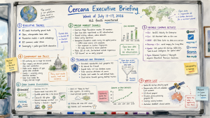
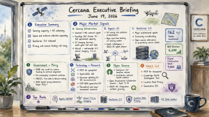
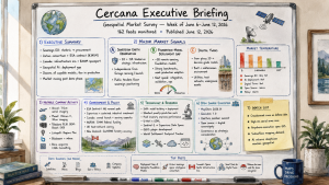
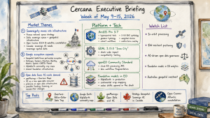
Cercana Executive Briefing — Week of April 11–17, 2026

153 feeds monitored. Published April 17, 2026.

Executive Summary

The defining story of this week is a convergence that both practitioners and strategists should track closely. Multiple independent demonstrations of AI agents operating inside QGIS arrived at the same time that QGIS 4.0.1 achieved full cross-platform availability. As demonstrated this week in Germany, Spain, and by independent practitioners, LLMs connected via the Model Context Protocol can execute 28 analytical steps inside the world’s most-deployed open-source GIS from a single text prompt. That development begins to shift the skill profile required for geospatial analysis in ways that will take years to fully understand. The critical counterpoint, voiced bluntly in a widely shared Medium piece titled “AI Hasn’t Landed for the Working GIS Analyst,” is that current tools are still not reliable under production conditions. Leaders should watch this gap between demonstration and deployment carefully because it defines both the opportunity and the risk.

The AI story is also advancing from a different direction. Earth foundation model infrastructure is maturing into deployable data systems. A billion-scale SAR model, planetary-scale pixel embedding compression for real-time change detection, and on-orbit AI processing demonstrations from Planet Labs and Belgian startup EDGX all point toward the same underlying change: geospatial intelligence is moving toward an automated, machine-read pipeline and away from a purely human-supervised workflow. OGC’s completion of its Rainbow research initiative this week offers institutional acknowledgment of that reality. Its conclusion was clear: human-readable standards cannot scale to automated systems.

The week’s funding picture supports the same thesis. Capella received $48.9M for tactical space communications, Earth Blox raised £6M for EO-based climate risk, and Plume raised $3.9M for AI-driven renewable energy site intelligence. Together, those moves suggest that governments and institutional investors increasingly view geospatial data as critical infrastructure for both defense and the energy transition.

Major Market Developments

AI Agents Enter GIS Workflows at Visible Scale

Multiple independent sources this week demonstrated AI agents autonomously executing complex GIS analysis inside QGIS. A Spanish GIS blog covered QGIS MCP, which integrates the Model Context Protocol with QGIS and allows Claude AI to drive analytical workflows through natural language commands. A German community blog highlighted a video demonstration in which a single prompt generated a complete map through 28 autonomous agent steps in 15 minutes. A third post covered LandTalk.AI, which brings Gemini and ChatGPT into QGIS map interpretation. These examples do not come from a single vendor or a coordinated campaign. Instead, they reflect an organic, distributed discovery moment across the QGIS user community. The strategic implication is substantial. If agentic GIS reaches production reliability, the barrier to performing complex geospatial analysis drops, the total market for geospatial intelligence expands, and demand for traditional GIS analyst roles may compress. At the same time, a blunt critical assessment published this week argues that AI tools still fail in practice when they encounter real-world geospatial data structures. The opportunity is real, but the timeline for reliable deployment remains unclear.

Earth Foundation Models Move From Research to Infrastructure

This week’s edition of The Spatial Edge covered a billion-parameter foundation model for SAR (synthetic aperture radar) image understanding. This is a breakthrough because SAR is the all-weather, day-night workhorse of serious Earth observation, yet it is notoriously difficult to train AI on because of speckle noise and geometric distortions. In parallel, GeoSpatial ML published the third installment of a series on compressing Earth embeddings using the Clay v1.5 foundation model, demonstrating per-pixel change detection served from static object storage at planetary scale. Alpha Earth embedding behavior across stable and changing land cover classes was also analyzed independently this week. Taken together, these posts show a sector that is no longer asking only whether the technology works. The question now is how to deploy it at scale. That marks a move from research into engineering. Organizations that depend on large-area monitoring for insurance, agriculture, or defense should be asking their vendors where they stand on foundation model integration.

On-Orbit AI Processing Reaches Commercial Demonstration

Planet Labs selected Alice Springs as the test site for a demonstration of on-board satellite AI, processing imagery at 500km altitude immediately after capture to identify aircraft without downlinking to ground first. Belgian startup EDGX launched its STERNA AI edge computing system into orbit on SpaceX’s Transporter-16 mission, designed for scalable deployment across satellite constellations. Spire also deployed a dedicated satellite for continuous Earth magnetic field mapping as part of the MagQuest challenge. These simultaneous moves, across different missions and vendors, point away from the traditional “collect then process” architecture and toward edge intelligence at the point of collection. The operational implications are profound: reduced latency for time-sensitive intelligence, lower ground station bandwidth requirements, and a new performance differentiation axis for EO vendors beyond resolution and revisit frequency.

Geospatial Standards Bodies Pivot to Machine-Readable Infrastructure

The OGC published the findings of its multi-year Rainbow research initiative this week and shifted the discussion into implementation. The core finding: standards written for human readers do not scale to a world where machines must interpret and act on geospatial data directly. The implementation phase introduces machine-readable Building Blocks and Profiles as modular, traceable components. That changes how geospatial interoperability specifications are written and consumed. In parallel, Phase 1 of the S-100 maritime data framework entered into force globally, allowing the maritime community to begin implementing next-generation chart specifications. Together, these developments suggest that the geospatial standards landscape is being redesigned around machine consumption. That matters for any organization procuring or building automated geospatial pipelines.

Notable Company Activity

Product Releases

  • SimActive: Released Correlator3D Version 11 with native Gaussian splatting integration, enabling photogrammetry workflows to produce high-quality 3D splat models from imagery. This significantly expands deliverable formats for survey and construction clients.
  • Mach9: Released Digital Surveyor 2, an AI feature extraction platform designed to address the bottleneck of converting LiDAR point clouds into engineering-usable features at scale. Geo Week News assessed it as addressing a genuine and growing pain point for survey and civil engineering teams.
  • Foursquare: Published detailed use cases for FSQ Spatial Agent, positioning the product as eliminating the technical barrier between domain experts and complex geospatial analysis by pairing reasoning AI with the FSQ H3 Hub data platform, with no GIS expertise required.
  • Giro3D (Oslandia): Released Giro3D 2.0, a major update to the open-source browser-based 3D geospatial visualization library, adding GPU-side processing for HD LiDAR and 3D Tiles with support for React and Vue.js integration.
  • MapTiler: Released OpenMapTiles 3.16 with improved road connectivity and enhanced dark-mode styling.

Partnerships

  • KSAT × Kongsberg NanoAvionics: Announced a strategic partnership to streamline smallsat mission deployment, reducing operational and financial burden for satellite operators by integrating ground station services with mission management from a single provider.
  • Hexagon × Vale: Hexagon’s R-evolution unit has begun aerial 3D mapping flights under the Green Cubes Digital Reality initiative, creating digital twins to support environmental reclamation across Vale’s mining operations in Brazil. This is a notable application of digital twin technology to ESG obligations at industrial scale.

Funding & M&A

  • Capella Space: Awarded $48.9M for advanced tactical space communications in low Earth orbit. It is a defense-oriented contract that reinforces Capella’s positioning at the intersection of SAR and government intelligence.
  • Earth Blox: Raised £6M for its climate risk platform built on Earth observation data. This is institutional capital chasing the intersection of EO and climate financial risk.
  • Plume: Raised $3.9M to build AI geospatial agents for renewable energy site intelligence. This niche is directly tied to the pace of energy transition investment.

Government and Policy Developments

The OGC’s Rainbow initiative represents the most consequential standards development of the week. The multi-year project, backed by EU Horizon Europe funding and partners including ESA, NRCan, UKHO, and NGA, concluded that geospatial standards must become machine-readable to support an automated world. The move to Building Blocks and Profiles as modular, machine-parseable components will take years to propagate through procurement and compliance requirements. Organizations building automated geospatial pipelines should track this transition closely because it will eventually reshape how contracts are specified and systems are certified.

The global S-100 maritime data standard Phase 1 entering into force is a parallel marker of the same structural shift. Shipping, port management, and maritime defense organizations should begin planning for the transition from traditional ENC chart formats to the S-100 product family.

In Europe, development of EuroCoreReferenceMap — a high-value large-scale geospatial dataset for EU policymakers — is underway, highlighting continued EU investment in sovereign spatial data infrastructure. In Canada, the OGC Canada Forum and the GeoIgnite conference are both building institutional momentum around digital sovereignty and national data connectivity. K2 Geospatial’s sponsorship of GeoIgnite under an explicit digital sovereignty banner reflects how Canadian vendors are positioning themselves around the theme.

The GeoAI and the Law newsletter provided a detailed analysis of California Governor Newsom’s Executive Order N-5-26, signed March 30, which places AI safety and accountability requirements into state procurement contracts rather than creating new legislation. This procurement-driven governance model effectively reaches every vendor selling AI-enabled products or services to California state government, including geospatial AI vendors, and may become a template for other states and federal agencies.

India’s Geospatial World published a substantive interview on India’s defence geospatial transformation, presenting space and geospatial technologies as central to strategic autonomy. The interview highlights a decade of accelerating integration of geospatial capability into military decision-making, indigenization policy, and international collaboration, underscoring India’s emergence as an increasingly important geospatial market for both data and platform vendors.

Technology and Research Trends

The technical direction of travel this week centers on three converging developments: agentic GIS, foundation model operationalization, and cloud-native format adoption in production environments.

On agentic GIS, the QGIS MCP ecosystem is developing rapidly without a single vendor driving it. That is a community-level adoption pattern, which historically has been more durable than vendor-led adoption in the geospatial sector. For technology leaders, the question is not whether AI-assisted GIS workflows will become standard. The real questions are how fast that happens and what reliability threshold organizations will require before they depend on these tools for consequential decisions.

On foundation models, the week’s most technically substantive post was GeoSpatial ML’s DeltaBit piece, which demonstrated pixel-level change detection at planetary scale by compressing Clay v1.5 Earth embeddings to a density suitable for browser-based serving. The engineering ambition of making dense per-pixel embeddings available to any user at global scale would fundamentally change how change detection products are built and delivered. The Spatial Edge’s coverage of the SAR billion-parameter model adds weight to the broader pattern that foundation models designed for EO data are becoming production-grade.

On cloud-native formats, a detailed case study from Swiss consultancy EBP described integrating InSAR ground deformation data into Switzerland’s national natural hazard platform using COG, PMTiles, Parquet, and DuckDB. This is the kind of production case study that turns format advocacy into demonstrated operational value. In a government infrastructure context, the combination of those four tools is also a useful measure of the cloud-native stack’s maturity.

Open Source Ecosystem Developments

QGIS 4.0.1 resolved a Mac distribution issue and is now fully available across platforms. The 4.0 release cycle is drawing intense practitioner attention as the community works through migration and workflow adaptation.

More important over the long term was a pair of posts from OPENGIS.ch, maintainers of QField and major QGIS contributors, articulating and publishing results from their #sustainQGIS initiative. In 2025, the firm invested 168 hours in QGIS maintenance work that included bug fixes, code reviews, refactoring, and test coverage. The funding mechanism is built into their commercial support contracts. Unused hours are donated, and a portion of every multi-day contract is reserved for initiative work. This “sustainability by contract” model addresses one of open source’s most persistent vulnerabilities: maintenance work that delivers no visible features but remains essential to long-term software health. Enterprise QGIS users who depend on the platform for mission-critical workflows should understand this model and consider whether their own procurement practices support or undermine it.

Giro3D 2.0 from Oslandia is a notable open-source release. It is a browser-based 3D visualization library with GPU-accelerated LiDAR and 3D Tiles support that is now integrated into production React and Vue.js applications. PostGIS issued simultaneous security patches across versions 3.2 through 3.6.

Watch List

  • Gaussian Splatting as a Production Survey Deliverable: SimActive’s Correlator3D v11 integrates Gaussian splatting natively, and Geo Week News published a dedicated analysis. This novel 3D representation technique is entering commercial photogrammetry after emerging from research. It is a potential disruptor to traditional point cloud and mesh formats worth tracking in survey and AEC workflows.
  • California AI Procurement Model: If California’s procurement-driven AI governance approach scales, it creates a de facto compliance requirement for geospatial AI vendors selling to government. Watch for adoption in other states and potential federal influence.
  • Celeste Constellation: The first two of eleven planned Celeste testbed satellites launched this week to supplement Galileo. European sovereign positioning infrastructure is developing a second track beyond Galileo itself.
  • Plume + Renewable Energy Site Intelligence: The $3.9M raise for AI geospatial agents targeting renewable energy siting taps into the energy transition capital cycle. A small seed round, but the product thesis — AI agents replacing manual geospatial analysis for site selection — is the same thesis as FSQ Spatial Agent applied to a high-growth vertical.
  • Apple Maps and Geopolitical Cartography: Apple denied this week that it removed Lebanese towns and villages from Apple Maps in connection with the Israeli invasion — a story that generated significant social media attention. The incident reflects growing scrutiny of how commercial map providers handle politically sensitive geographic representation. This is a reputational and regulatory risk vector for any organization operating consumer-facing mapping products.

Top Posts of the Week

  1. QGIS MCP: conecta Claude AI con QGIS y automatiza tu flujo de trabajoMappingGIS — The most shared practical demonstration this week of LLM-driven GIS automation; the clearest articulation of what agentic QGIS looks like in practice for a non-technical audience.
  2. A billion-scale model for understanding radar imagesThe Spatial Edge — Covers multiple converging EO AI research developments including the SAR foundation model, global 1m forest canopy heights from Meta/WRI, and cloud-free imaging advances; the week’s best single-source EO research summary.
  3. From Research to Implementation: Building Shared Infrastructure for an Automated WorldOpen Geospatial Consortium — OGC’s formal announcement of its shift from research to implementation of machine-readable geospatial standards. This is a consequential development with long-horizon procurement implications.
  4. GeoAI and the Law NewsletterSpatial Law & Policy — Detailed analysis of California’s procurement-driven AI governance order; the most substantive policy analysis of the week for geospatial AI vendors serving government.
  5. QGIS Sustainability Initiative – Annual ReportOPENGIS.ch — A rare transparent accounting of how a commercial QGIS services firm funds open-source maintenance. It is directly relevant to any enterprise organization assessing the sustainability of its QGIS dependency.

Cercana Executive Briefing is generated from 153+ feeds aggregated by geofeeds.me.

Cercana Executive Briefing — Week of April 4 –10, 2026

152 feeds monitored. Published April 10, 2026.

Executive Summary

The defining story of this week is the release of the White House FY 2027 budget request, which proposes a 23% cut to NASA’s overall budget and a catastrophic 47% reduction to the Science Mission Directorate. This would be the largest proposed science cut in NASA’s history. For the geospatial and Earth observation market, this is not a routine policy development. It accelerates a structural transition already underway: as the public data foundation erodes, the commercial and defense sectors are being asked to fill the gap. EarthDaily’s announcement of an eight-figure AI-ready data subscription deal with a U.S. defense and intelligence technology company, published in the same week, is not a coincidence. It is the market responding in real time.

Two threads reinforce each other this week. The budget threat to NASA and NOAA concentrates the risk of data dependency on a shrinking number of commercial providers, while simultaneously opening a procurement runway for those same providers with defense and intelligence buyers. Companies positioned at the intersection of AI-ready EO data and national security are the near-term beneficiaries. Everyone dependent on NOAA weather streams, USGS terrain data, or open NASA science missions faces a more expensive and fragmented supply chain.

Meanwhile, the AI-in-geospatial debate deepened, with serious independent analysts asking hard questions about whether large language models actually understand spatial data. That is evidence that the industry is moving beyond hype toward more disciplined evaluation. QGIS 4.0.1’s release alongside the LTR patch reinforces open-source momentum as a strategic hedge. Leaders should be paying attention to the budget, the defense data opportunity, and the growing scrutiny of AI geospatial claims.

Major Market Developments

The NASA Budget Shock Reshapes the EO Supply Chain

The White House FY 2027 budget request, released this week, proposes the largest cut to NASA’s science programs in the agency’s history. It includes a 47% reduction to the Science Mission Directorate that would bring science funding to its smallest level in decades. Project Geospatial published two separate analyses of the implications, examining both the direct market impacts and the broader ecosystem effects across the geospatial sector. The consequences are structural, not cyclical. Missions covering climate, Earth observation, and geodetic infrastructure face termination or indefinite suspension. Companies reliant on open NASA data streams in agricultural analytics, climate risk, flood modeling, and insurance will face higher data acquisition costs and supply disruption. The downstream effect on geospatial R&D pipelines through NSF and university grant programs compounds the damage. This is the single most important market development of the quarter.

Defense & Intelligence Emerge as the Anchor EO Customer

Against the backdrop of civilian budget collapse, EarthDaily announced an eight-figure AI-ready data subscription agreement with a U.S. defense and intelligence technology company. The deal is significant on multiple dimensions: it signals that defense buyers are now transacting at scale on commercially produced, AI-optimized EO data; it validates EarthDaily’s product positioning around calibrated, analytics-ready imagery; and it marks a maturation of the defense-commercial data relationship from ad hoc purchases toward structured subscriptions. This is precisely the market dynamic that emerges when public data infrastructure weakens. Commercial providers that can meet intelligence-grade consistency requirements gain strategic leverage. Expect similar announcements from other EO platforms as DoD and IC agencies accelerate commercial data integration.

AI Spatial Literacy Under Scrutiny

Two independent, high-quality voices this week focused on the same question from different angles: do AI models actually understand geography? The Spatial Edge published a rigorous examination of whether large language models can correctly interpret GPS coordinates and spatial relationships, finding significant limitations that have direct implications for any workflow deploying LLMs on geospatial tasks. Separately, Bill Dollins at geoMusings published a second installment on spatial analysis with Claude, and GoGeomatics covered NV5’s GeoAgent AI platform for agentic geospatial analysis. The convergence is meaningful: the industry is moving from enthusiasm about AI geospatial integration toward closer scrutiny of where these systems actually work and where they fail. Organizations deploying AI in spatial workflows should treat spatial literacy as a first-order evaluation criterion, not an assumption.

North American Geospatial Sovereignty Anxiety Intensifies

Canada generated two substantive policy-oriented posts this week, both pointing to the same underlying concern. GoGeomatics published an analysis arguing that Canada’s geodetic infrastructure is a hidden geospatial risk requiring immediate policy attention, noting that the country’s coordinate reference framework and positioning infrastructure lack the policy protection given to other critical infrastructure. A companion piece argued that Canada’s geospatial workforce framework is dangerously outdated and must be modernized to maintain competitiveness. These are not isolated concerns. They mirror the U.S. federal budget threat at a structural level. The issue of national geospatial sovereignty, covering both data independence and workforce capacity, is surfacing across multiple geographies at once and is becoming a credible policy agenda item.

Notable Company Activity

Product Releases

  • EarthDaily: Announced an eight-figure AI-ready data subscription agreement with a U.S. defense and intelligence technology company. It is the most commercially significant EO deal disclosed this week. The agreement underscores growing appetite for calibrated, analytics-ready imagery at defense contract scale.
  • Ecopia: Launched a self-serve platform for high-precision geospatial data downloads, lowering the barrier for enterprise and mid-market buyers to access building footprint and feature extraction data without a direct sales engagement. The move suggests Ecopia is broadening its addressable market beyond large enterprise deals.
  • NV5 / GeoAgent AI: GoGeomatics featured NV5’s GeoAgent platform, positioning it as an agentic AI system for geospatial analysis. The coverage highlights the company’s push to embed automation into traditional imagery and analysis workflows.
  • Esri: Released Q1 2026 basemap updates covering more than 200 new and updated communities, alongside new ArcGIS for Excel routing capabilities, density analysis enhancements, and an early adopter program for ArcGIS Maps for Microsoft Fabric integration.
  • geoparquet-io: A fast new GeoParquet processing tool was flagged by Spatialists, gaining attention for performance improvements in cloud-native geospatial workflows.

Partnerships & M&A

  • Blue Marble Geographics × Avenza Systems: The two companies announced a merger, combining Blue Marble’s coordinate transformation and geodetic software with Avenza’s field mapping and PDF map products into a unified field-to-office geospatial platform. This is the most structurally interesting consolidation of the week. It brings together two complementary niche players that are combining to compete at a platform level.
  • Astroscale × Exotrail: The two companies advanced France-Japan cooperation on space sustainability through a joint satellite servicing initiative. Astroscale separately announced the world’s first commercial multi-orbit satellite inspection mission, a capability with long-term implications for satellite asset management and constellation health monitoring.

Government and Policy Developments

The FY 2027 White House budget proposal dominates the policy landscape this week. If enacted, the proposed 23% overall cut to NASA, together with the 47% reduction to the Science Mission Directorate specifically, would represent the most severe contraction of U.S. civil Earth observation capability in the agency’s history. Project Geospatial’s two analyses this week frame the implications clearly: the downstream effects extend well beyond NASA itself, touching NOAA weather and climate data streams, USGS terrain and mapping programs, and the university research pipelines that generate geospatial talent and technology. The budget proposal is not yet enacted and will face congressional scrutiny, but the directional signal is unambiguous. Companies and government agencies that have built workflows on open federal data must begin contingency planning now.

FedGeoDay 2026 received a sponsorship announcement from GeoSolutions, with the event organized around “Building Ecosystems for Supporting Federal Data Stewardship,” a focus that now carries considerable urgency given the budget context. The OGC published a blog post on common challenges in geospatial integration, addressing standards interoperability issues that remain a persistent friction point across both commercial and government deployments. In Australia, Spatial Source reported on the ACT’s plans to introduce a Certificate IV in Surveying in 2027, addressing workforce pipeline gaps, while New Zealand announced grants for surveying and spatial projects — both examples of national-level investment in geospatial workforce capacity that contrasts with the U.S. federal posture.

Technology and Research Trends

The most technically interesting item this week came from GeoSpatial ML, which published the second installment of its TerraBit series on compressing earth embeddings. It explores how foundation model representations of satellite imagery can be made more efficient for downstream analytics. This work matters because the computational cost of running geospatial foundation models at scale remains a significant deployment barrier; compression approaches that preserve analytical fidelity while reducing model footprint could materially ease deployment.

The question of AI spatial literacy, meaning whether LLMs actually understand geographic coordinates and spatial relationships, received rigorous attention this week. The Spatial Edge’s analysis suggests that current models exhibit significant limitations in interpreting raw GPS coordinates. This finding has direct implications for anyone building pipelines in which an LLM is expected to reason over latitude/longitude pairs, bounding boxes, or spatial predicates without a dedicated geospatial processing layer.

SAR and optical satellite fusion continued to attract research attention, with a Medium post from Earth Observation on Medium exploring the scientific future of multi-modal fusion. SLAM LiDAR received a detailed explainer from Geo Week News, and the Artec Jet survey-grade mobile LiDAR scanner launch from Artec 3D signals continued commercialization of autonomous 3D site mapping. Sparkgeo published an analysis on the intersection of geospatial data, climate change, and financial risk, a theme gaining traction among climate-linked insurance and ESG-oriented investors.

Open Source Ecosystem Developments

QGIS had a significant release week. Both QGIS 4.0.1 “Norrköping” and the long-term release patch 3.44.9 “Solothurn” became available simultaneously for Windows, Linux, and macOS, as noted by #geoObserver. The dual-track release reflects the QGIS project’s mature release management, and the 4.0.x line is worth watching: each incremental patch strengthens the platform’s stability and makes enterprise adoption easier to consider.

Bill Dollins at geoMusings published a thoughtful essay on OGC’s RFC 1 and the long arc of technical stewardship in geospatial standards. It is a rare piece of standards governance reflection and is worth reading for anyone tracking how community-governed technical infrastructure evolves over time. The Cloud-Native Geo (CNG) community launched a mentorship pilot program, an early-stage effort to build community capacity that deserves monitoring as a potential indicator of organizational maturation. The geoparquet-io tool’s emergence as a fast GeoParquet processing option reflects continued developer interest in cloud-native geospatial formats, and the broader GeoParquet ecosystem is gaining tooling depth.

Oslandia published a client case study on QGIS deployment at LPO AuRA (a French conservation organization), illustrating how open-source geospatial tooling is reaching non-traditional enterprise users in the environmental sector. This is an underappreciated sign of adoption: QGIS’s penetration into biodiversity and conservation organizations points to a market segment that proprietary vendors have historically underserved.

Watch List

  • Earth embedding compression (TerraBit): GeoSpatial ML’s work on compressing geospatial foundation model embeddings is early-stage but directionally important. If successful at scale, it closes a meaningful deployment gap for EO AI applications. Monitor for follow-on papers and tooling.
  • Generative satellite imagery (DiffusionSat): Helios TechBlog’s practical evaluation of metadata-conditioned diffusion models for satellite imagery generation suggests that synthetic EO data pipelines are moving from theory toward tooling. Authenticity verification and provenance tracking will follow as a market need.
  • Emergency management as a latent geospatial market: Project Geospatial published an analysis arguing that emergency management is a market that geospatial vendors have repeatedly misjudged. It appears unsuitable until a disaster triggers procurement urgency. With climate event frequency rising, watch for procurement spikes.
  • Matadisco open data discovery network: MappingGIS covered Matadisco, a new open and decentralized network for geospatial data discovery. If it gains adoption, it could challenge centralized data catalogs and shift discoverability dynamics in the open data ecosystem.
  • GNSS interference as a commercial risk factor: Geo Week News ran a piece on GPS/GNSS interference as a resilience concern across geospatial and AEC industries. With interference incidents increasing in conflict zones and beyond, positioning assurance is becoming a product category, not just a military problem.

Top Posts of the Week

  1. One Large Step Back for Science, One Giant Leap Backward for Earth Observation. Geospatial Frontiers – Project Geospatial. It is the most important piece of the week: a detailed analysis of the FY 2027 NASA budget proposal’s market implications for the Earth observation and broader geospatial sector.
  2. EarthDaily Secures Eight-Figure AI-Ready Data Subscription Agreement with US Defense & Intelligence Technology Company. EarthDaily Blog. It provides defense-sector validation of commercial AI-ready EO data at subscription scale, arriving precisely as the public data foundation weakens.
  3. Do AI Models Actually Understand GPS Coordinates?. The Spatial Edge. It is a rigorous independent examination of LLM spatial literacy, with direct implications for geospatial AI pipeline design.
  4. The Ground Shifts Beneath Us: The Geospatial Ecosystem in the Shadow of the FY 2027 Budget. Geospatial Frontiers – Project Geospatial. It is the broader ecosystem analysis complementing the NASA-focused piece and examining cascading effects across NOAA, USGS, and the R&D pipeline.
  5. Canada’s Hidden Geospatial Risk: Why Geodesy Needs Policy Attention. GoGeomatics. It offers a clear-eyed argument for treating geodetic infrastructure as critical national infrastructure, with implications for any organization dependent on national coordinate reference systems.

Cercana Executive Briefing is generated from 152 feeds aggregated by geofeeds.me.

Cercana Executive Briefing — Week of March 28–April 3, 2026

152 feeds monitored. Published April 3, 2026.

Executive Summary

The most consequential development this week was the publication of the CNG Geo-Embeddings Sprint report, which moved earth observation embeddings from an emerging research thread into the standards-drafting phase. Co-hosted by CNG, Planet, and Clark University, the March sprint produced concrete patterns for storing, cataloging, and accessing EO embeddings. This is the kind of infrastructure specification work that typically precedes commercial adoption. This matters because embeddings are one of the mechanisms through which satellite imagery can be translated into forms that AI systems can use at scale. Organizations making infrastructure decisions about their EO data pipelines should be watching this thread closely. Standards that solidify here will shape which analytics platforms interoperate and which become walled gardens.

In parallel, the defense and intelligence conversation intensified. Project Geospatial published two substantial pieces, one on GeoAI-driven military targeting ethics and another on the geopolitics of quantum gravity gradiometry, while Octave rebranded Luciad as Alto 2026.0 with explicit cyberthreat visualization capabilities for defense. Taken together, these developments suggest that the defense geospatial market is expanding its technical scope while also confronting the ethical consequences of that expansion. Meanwhile, Canada’s national geospatial strategy consultations drew critical coverage revealing a system with depth but without alignment, and Australia launched the Locus Alliance to replace its collapsed national geospatial body. The pattern across both is institutional. Countries are renegotiating how geospatial infrastructure is governed, and the outcomes will likely shape procurement structures for years.

Major Market Signals

EO Embeddings Move from Research to Standards

The CNG Geo-Embeddings Sprint brought together Planet, Clark University, and other organizations to draft best practices for storing, cataloging, and accessing Earth observation embeddings. This is not another AI capabilities announcement. It is infrastructure specification work. When the EO community starts defining how embeddings are stored and discovered, it suggests that the technology has matured enough for interoperability to matter. For platform vendors and data infrastructure buyers, this is the stage at which architectural decisions can begin to lock in compatibility or isolation. The sprint outputs are headed for community review, which means a public comment period that organizations with EO data pipelines should engage with.

Defense Geospatial Expands Scope and Confronts Ethics Simultaneously

Two distinct but convergent threads emerged this week. Octave launched Alto 2026.0, the rebranded Luciad platform, adding cyberthreat visualization for defense and extending geospatial situational awareness into the cyber domain. Simultaneously, Project Geospatial published a deeply personal account of how GeoAI-driven military targeting is eroding the oversight structures that governed intelligence operations for decades. That convergence is the real signal. The defense geospatial market is rapidly expanding what these tools can do while governance frameworks struggle to keep pace. For vendors entering the defense space, the ethics conversation is no longer peripheral. It is becoming a procurement consideration.

National Geospatial Governance Under Reconstruction

Canada’s NRCan geospatial strategy consultations drew critical analysis from GoGeomatics and EarthStuff, revealing systemic gaps in coordination, infrastructure governance, and institutional alignment. In Australia, the newly formed Locus Alliance launched to fill the void left by the collapsed Geospatial Council of Australia. These are not isolated developments. Multiple countries are simultaneously renegotiating how geospatial infrastructure is governed at the national level. For vendors and service providers, the restructuring of national geospatial bodies directly shapes procurement pipelines, standards adoption, and public-sector contract structures.

Quantum Sensing Enters the Geospatial Regulatory Conversation

Project Geospatial’s deep analysis of quantum gravity gradiometry regulation, combined with SBQuantum’s announcement of a space-bound quantum magnetometer as part of the US government’s MagQuest Challenge, marks the week when quantum sensing moved from theoretical interest to a dual regulatory and commercial question. Quantum gradiometry can reveal subsurface structures, including those with defense and resource extraction significance, at resolutions that current regulatory frameworks were not designed to address. It is still early, but this looks like a genuine market-formation signal worth tracking.

Notable Company Activity

Product Releases

  • Octave (Alto 2026.0): Rebranded its Luciad platform as Alto and launched version 2026.0 with cyberthreat visualization capabilities for defense situational awareness. The rebrand sharpens Octave’s positioning as a defense-focused geospatial intelligence platform.
  • MapTiler: Released April updates that included professional grid overlays and a major satellite imagery refresh across its basemap products.
  • USGS: Released a machine learning tool that forecasts streamflow drought conditions up to 90 days ahead nationwide. This is a significant applied AI deployment for water resource management.
  • Esri: Released the Protected Area Management solution and March 2026 ArcGIS Solutions update, alongside updates to its geocoding and world traffic services.

Partnerships

  • DroneDeploy × Cairn: Enterprise-wide aerial and ground reality capture partnership for housing development portfolio management. A useful example of reality capture moving from project-level use to portfolio-level deployment in construction.
  • Astroscale × Exotrail: Advancing France-Japan cooperation on space sustainability and on-orbit servicing, backed by a visit from Emmanuel Macron and Sanae Takaichi.

Funding & M&A

  • Xona Space Systems: Closed an oversubscribed $170M Series C to accelerate deployment of its Pulsar LEO navigation constellation. Investors include Hexagon, Craft Ventures, and Samsung Next. The round suggests strong market confidence in GPS-alternative positioning infrastructure.
  • Trimble: Signed an agreement to acquire Document Crunch, an AI-powered construction document analysis and risk management company, integrating it into the Trimble Construction One ecosystem.
  • Woolpert: Awarded a $49.9M USACE contract to support I-ATLAS coastal mapping and nautical charting efforts. It is a significant federal LiDAR and survey contract.

Government and Policy Developments

The US National Geodetic Survey’s NSRS modernization effort was the subject of a Geo Week News webinar bringing together NGS leadership and the geospatial community. The message was practical. The reference frame transition is coming, and the community should be preparing rather than worrying. For survey and mapping firms, the modernization will affect nearly every coordinate-dependent workflow in the US market, and early preparation is likely to be an advantage.

Canada’s geospatial strategy consultations drew substantive analysis revealing that while the country has depth in geospatial capabilities, it lacks consistent alignment across governance, infrastructure, and coordination. NRCan’s consultations are surfacing long-standing structural problems rather than resolving them. Sparkgeo’s piece on building a national urban forest data view illustrated both the ambition and the fragmentation of Canadian geospatial infrastructure.

In Australia, the Locus Alliance launched as a new national geospatial body to fill the gap left by the Geospatial Council of Australia’s collapse. The Alliance aims to be structurally different from its predecessor, though details of its governance are still emerging. The Ordnance Survey in the UK announced that its National Geographic Database now holds 16 data collections and 70 major enhancements, positioning Britain’s national mapping as a continuously updated digital product rather than a periodic release.

Technology and Research Trends

The technology story of the week centers on the maturation of EO data infrastructure. CNG’s Geo-Embeddings Sprint produced actionable specifications rather than aspirational roadmaps, while EarthDaily published on how real-time crop signals from its constellation are changing agricultural market decisions. It was one of the rarer posts connecting EO technology directly to commercial demand-side outcomes. TerraWatch’s “Anatomy of an Earth Observation Use Case” offered a structural critique of how the EO industry uses (and misuses) the term “use case,” pushing toward more rigorous framing of what makes an EO application commercially viable.

The Spatial Edge’s weekly digest covered satellites mapping local human development levels, LLMs estimating flood damage without training data, and foundation models for ecological mapping. Taken together, these offer a concentrated snapshot of where applied spatial data science seems to be heading. The through-line across these is the compression of traditional multi-step geospatial workflows into single-model inference. That has implications for both the skills market and the value chain.

Spatialists covered Stefan Ziegler’s work raster-enabling Apache Hop with GDAL-based transforms, demonstrating practical LiDAR-to-building-height ETL pipelines. This is exactly the kind of hands-on cloud-native geospatial tutorial content that has been persistently absent from the ecosystem. It stands out in part because material of this kind is still relatively rare.

Open Source Ecosystem Signals

The open-source ecosystem had a quieter week following the QGIS 4.0 and FOSSGIS 2026 activity of recent weeks. geoObserver noted a QGIS tip on SFCGAL functions now available as a plugin, which is better understood as a post-4.0 ecosystem refinement than a headline release. geoObserver also reflected on FOSSGIS 2026 and celebrated 44,444 downloads of the GeoBasis_Loader plugin, a milestone for the German open-data geospatial tooling community.

The Spatialists coverage of Apache Hop raster enablement is worth flagging here as well: the hop-gdal-plugin extends an open-source ETL framework with geospatial raster capabilities, bridging the gap between data engineering and geospatial processing. It represents the kind of cross-pollination between general-purpose open-source tooling and geospatial-specific capabilities that tends to strengthen the broader ecosystem.

The CNG Geo-Embeddings Sprint, covered in Market Signals above, also carries open-source ecosystem significance: the sprint’s outputs are intended for community review and adoption, meaning they will likely influence how open-source EO tooling handles embedding storage and discovery.

Watch List

  • Spiral Blue (Australia): Delivered space LiDAR hardware to a UK company as part of its strategy to build an EO space LiDAR capability. Space-based LiDAR is a nascent market with potentially transformative implications for forestry, bathymetry, and terrain mapping if costs come down.
  • Geospatial data and the EU Deforestation Regulation (EUDR): Coverage on Medium explored the geolocation data challenges and compliance implications of the EUDR. The regulation will create a distinct demand signal for geospatial verification services across commodity supply chains.
  • SBQuantum’s space quantum magnetometer: The MagQuest-funded mission could initiate a new class of GPS-independent navigation and subsurface sensing from orbit. If the technology performs, it opens regulatory and commercial questions that the geospatial industry has not yet grappled with.
  • Mainz cloud-native geospatial infrastructure: A German city implementing a fully cloud-based geospatial data infrastructure with VertiGIS and Esri. Municipal adoption of cloud-native GDI at this scale is an early but meaningful demand signal for enterprise cloud geospatial platforms in European public administration.

Top Posts of the Week

  1. Geo-Embeddings Sprint: Advancing standards for Earth observation embeddings (CNG Blog) moves EO embeddings from research into standards specification, with direct implications for data infrastructure interoperability.
  2. The New Battlespace: How Geospatial AI, Outdated Intelligence, and the Illusion of Oversight Are Reshaping Military Targeting (Project Geospatial) is a deeply informed and personal account of how GeoAI is outpacing the governance structures designed to prevent intelligence failures.
  3. The Anatomy of an Earth Observation Use Case (TerraWatch Space) offers a structural critique of how the EO industry frames commercial viability and pushes beyond “use case” as marketing shorthand.
  4. The Subsurface Geopolitics: Regulating the Commercial Use of Quantum Gravity Gradiometry (Project Geospatial) maps the emerging regulatory landscape for a technology that can reveal what lies underground at unprecedented resolution.
  5. Three Geospatial AI Myths Federal Buyers Should Not Believe (Cercana Systems) provides practical procurement-focused guidance that cuts through GeoAI marketing claims for federal decision-makers.

Cercana Executive Briefing is derived from 152 feeds aggregated by geofeeds.me.

Cercana Executive Briefing — Week of March 21–27, 2026

142 feeds monitored. Published March 27, 2026.

Executive Summary

The clearest story of this week is the merging of two narratives that have been running in parallel: sovereign AI and geospatial intelligence. On Sunday, GoGeomatics published a piece authored by Will Cadell whose title states the thesis plainly: “SovereignAI is GeoAI.” Within 72 hours, Australia made three distinct institutional moves: Geoscience Australia launched a new 10-year national strategy; a new National Geospatial Advisory Committee was announced with cross-sector representation; and Geospatial World ran a feature on Australia’s Austral-Asian Space Innovation Institute discussing sovereign satellite capability and the National Digital Twin for Agriculture. This is not messaging from one company — it is institutional behavior from a government treating geospatial infrastructure as strategic national infrastructure.

That same framing is arriving in U.S. federal policy. The GeoAI and the Law Newsletter this week dissected the Artificial Intelligence Regulation and Safeguards Act and found an expanded geolocation definition that could reshape how geospatial companies collect and use location data. The GSA’s proposed AI contract clause for federal procurement is described as the most consequential shift for geospatial vendors in years.

Meanwhile, European standards are in flux. Javier de la Torre’s analysis of the INSPIRE Directive simplification argues this is not mere bureaucratic tidying but an opening to embrace analytics-native paradigms, which is a structural shift in how European geospatial infrastructure is conceived.

Across all three developments, the same question is being asked simultaneously in Washington, Brussels, Canberra, and Ottawa: what does geospatial data mean for national capability? Leaders who treat this as a technical standards conversation are reading it wrong. It is a strategic infrastructure conversation, and the answer is being written this week in policy documents, not product roadmaps.

Major Market Signals

SovereignAI and GeoAI Are Converging as a Policy Frame

GoGeomatics published “SovereignAI is GeoAI” on March 22, arguing that national AI sovereignty strategies are fundamentally geospatial challenges, asserting that understanding territory, movement, resources, and infrastructure at scale requires geospatial intelligence as a foundational layer. Within days, Australia produced three institutional signals in the same direction: a new 10-year strategy from Geoscience Australia framed around shaping “Australia’s future through geoscience insights”; a new National Geospatial Advisory Committee advising government; and a Geospatial World feature on the Austral-Asian Space Innovation Institute discussing sovereign satellite capability and the National Digital Twin for Agriculture. Canada is also in motion: the retirement of CCMEO Director General Eric Loubier after 25 years is characterized by GoGeomatics as arriving at a “critical time” for Canada’s geospatial sector. The policy frame is hardening across the middle powers, with geospatial seen as strategic infrastructure, not technical tooling.

U.S. Federal GeoAI Regulation Is Taking Shape

The Artificial Intelligence Regulation and Safeguards Act, which the GeoAI and the Law Newsletter calls the “Trump AI Act,” contains an expanded geolocation definition that could require geospatial companies to alter how they collect, store, and use location data. Separately, the GSA’s proposed AI contract clause would affect how federal agencies procure AI-enabled geospatial services. The White House push for a unified federal AI standard would supersede the patchwork of state-level rules that geospatial companies currently navigate. Taken together, these three instruments represent the most significant regulatory shift for the U.S. geospatial market since CIPSEA. Companies with federal contracts or location-data products should be conducting legal exposure assessments now, not after enactment.

Commercial EO Capacity Is Expanding Across Multiple Modalities Simultaneously

Three distinct capability additions arrived this week: Synspective successfully placed its 8th StriX SAR satellite in orbit, continuing its build toward a 30-satellite constellation by 2030; Satellogic announced its Merlin satellite will deliver daily 1-meter resolution optical imagery; and Open Cosmos launched what it describes as the largest space-based real-time data service, fusing broadband connectivity, Earth observation, and IoT in a single platform. The pattern is consistent with broader commercial EO maturation: higher revisit, higher resolution, and tighter integration with downstream data pipelines. Organizations that have been waiting for the market to stabilize before committing to EO-based workflows should note that the infrastructure is arriving whether they are ready or not.

European Geospatial Standards Infrastructure Is at a Decision Point

Javier de la Torre’s analysis in Spatialists — titled “geo beyond INSPIRE” — frames the simplification of the EU INSPIRE Directive not as a retreat but as a structural opportunity. The argument is that INSPIRE’s interoperability-first model, built for a previous era, is increasingly misaligned with how geospatial data is actually consumed. Analytics-native paradigms, where data is designed for computation from the start, not formatted for exchange, offer a better fit for the AI-era use cases now driving demand. The OGC simultaneously announced its Testbed on Trusted Data and Systems has expanded beyond Europe to include non-European NMCAs, reflecting growing global interest in how authoritative public geospatial data can be modernized and made computationally useful. These two developments together mark a transition moment for European and global geospatial standards. The question is not whether INSPIRE changes, but who shapes what replaces it.

Notable Company Activity

Product Releases

  • Esri: A coordinated spring release wave this week covered ArcGIS GeoAnalytics Engine 2.0 (cloud-scale spatial analytics), ArcGIS Urban (March 2026 update), ArcGIS StoryMaps (March 2026), ArcGIS Pro SDK updates, R-ArcGIS Bridge Spring 2026, and Lidar updates to World Elevation Layers in Living Atlas. The breadth and simultaneity of these releases signals a major platform release cycle, not incremental maintenance.
  • Satellogic: The Merlin satellite will offer daily 1-meter optical imagery, a meaningful step toward sub-daily revisit at commercial resolutions.
  • Open Cosmos: Announced what it calls the largest space-based real-time data service, combining broadband connectivity, Earth observation, and IoT telemetry in a single commercial offering.
  • Septentrio: Launched the AsteRx EB, a compact high-accuracy GNSS receiver targeting robotics, logistics, and industrial automation, extending precision positioning into non-traditional industrial sectors.
  • SBG Systems: Unveiled the Stellar-40, a modular and scalable inertial navigation system for demanding and mission-critical environments.
  • Apple: Announced that ads will come to Apple Maps in the United States and Canada beginning this summer via its new Apple Business platform.

Partnerships

  • ANELLO Photonics × Q-CTRL: A strategic collaboration combining silicon photonics inertial sensing with quantum magnetic navigation, targeting UAV operation in GPS-denied environments. The press release cites a $1 billion-per-day global cost from navigation failures, a finding that may attract defense and logistics attention.
  • Kongsberg Discovery × Fugro: A new Main Supplier framework agreement formalizing a decades-long relationship between the ocean technology and subsurface surveying firms.
  • Seabed 2030 × Greenroom Robotics: The international seabed mapping program partnered with the Australian autonomous vessel company to expand ocean floor data collection.

Funding & M&A

  • Arlula: Raised A$3.4 million to build out software workflows for automated satellite tasking and imagery analysis. This is a small-ticket award but is strategically directional in the EO automation space.
  • e-GEOS (Leonardo Group): Won a contract from Italy’s Ministry of Environment and Energy Security to conduct nationwide satellite mapping of asbestos.

Government and Policy Developments

Australia produced the most concentrated national geospatial policy activity of the week. Geoscience Australia launched a 10-year strategy framed explicitly around national capability, with ministerial endorsement. A new National Geospatial Advisory Committee was established to provide cross-sector advice to government. And the Austral-Asian Space Innovation Institute’s founding CEO used a Geospatial World platform to articulate how sovereign space capability, satellite constellation data, and the National Digital Twin for Agriculture are linked strategic assets. Three announcements in four days from one government signals that geospatial is a designated policy priority in Canberra, not a technical afterthought.

Canada’s situation is the mirror image: a leadership vacuum at CCMEO is arriving precisely when Canada needs to respond to both sovereignty pressures and a rapidly changing EO commercial market. GoGeomatics’ framing of this as a “critical time” reflects the real institutional risk that mid-cycle leadership transitions at national mapping agencies have historically been associated with delayed procurement decisions and stalled modernization programs.

In the United States, the GeoAI and the Law Newsletter’s detailed reading of the Artificial Intelligence Regulation and Safeguards Act and the GSA’s proposed AI procurement clause deserves board-level attention for any company selling geospatial AI capabilities to federal agencies. The expanded geolocation definition in the proposed legislation is not incidental and it appears to bring a wider range of location data products within the act’s scope than current law covers.

The OGC’s Testbed on Trusted Data and Systems is worth tracking as a governance model. Originally launched as Testbed Europe, its expansion reflects interest from non-European NMCAs who face the same modernization challenge: how to make authoritative public spatial data computationally useful without sacrificing trustworthiness. This is engineering work with standards implications that will matter across every market where national mapping agencies are significant data providers.

Ordnance Survey data is also anchoring a new UK multi-agency emergency communications system designed to reduce the time required to transfer incident data between control rooms, demonstrating a practical example of authoritative location data embedded in safety-critical infrastructure.

Technology and Research Trends

The Spatial Edge newsletter this week highlighted research in Nature Communications integrating seismic risk modeling, geospatial infrastructure inventory, and climate accounting that shows earthquake-related building repairs generate massive CO2 emissions. The implication for the market is directional: insurers, municipal governments, and climate-disclosure frameworks will need spatial datasets that link physical risk exposure to embodied carbon accounting. This is an early signal of a new analytical product category.

QGIS Server gained time-series (WMS-T) support for grouped layers this week, contributed by Oslandia in collaboration with Ifremer, the French oceanographic research institute. The technical significance extends beyond the feature: it enables institutional EO data providers to distribute time-varying imagery through standards-compliant web services without bespoke infrastructure. As more governments look to publish national EO datasets via QGIS-based portals, this capability removes a meaningful barrier.

Swiss cadastral survey data is now available in IFC format for BIM integration via geodienste.ch, with four cantons participating and more expected. This represents one of the first examples of authoritative cadastral data crossing the traditional boundary between GIS and building information modeling workflows. For vendors selling into the AEC sector, it is a signal that the BIM-GIS convergence is becoming a data standards reality, not just a vision document.

The “Shortening Translation Distance” essay by Bill Dollins in geoMusings this week offered a practitioner’s-eye view of how AI code generation is changing the relationship between user-centric domain knowledge and programming in geospatial work.

Open Source Ecosystem Signals

FOSSGIS 2026, the annual German open-source geospatial conference, took place this week in Göttingen. The CCC (Chaos Computer Club) published Day 1 session recordings on the same day as the presentations, which is described by geoObserver as a record turnaround that reflects both organizational maturity and the community’s commitment to accessibility. For organizations evaluating open-source geospatial tooling, FOSSGIS 2026 session recordings represent a concentrated resource: they document the current state of practice across QGIS, PostGIS, MapLibre, GeoServer, and adjacent tools, often before formal release notes appear.

Oslandia had a notable week in the European open-source ecosystem: the QGIS Server WMS-T contribution for Ifremer (technical post published), a recap of the QGIS-Fr French user days, and an announcement of GeoDataDays 2026 in Tours. Oslandia’s activity this week illustrates how open-source QGIS ecosystem contributors operate as professional services firms with direct government and research institution clients. This is model that can mitigate lifecycle concerns in procurement decisions for public sector geospatial programs.


Watch List

  • Apple Maps advertising model: If Apple’s entry into map advertising succeeds commercially, it will pressure Google to expand its own ad surface area in Maps, potentially restructuring the economics of consumer location data platforms globally. B2B geospatial vendors whose products sit downstream of consumer map data APIs should monitor closely.
  • OGC MUDDI standard: The OGC published a detailed narrative this week on the MUDDI (Model for Underground Data Definition and Integration) standard, framing it as a model for cross-system urban spatial data interoperability. Underground infrastructure mapping is a large, fragmented market and a maturing standard here could unlock significant procurement activity.
  • GPS-denied navigation commercialization: The ANELLO/Q-CTRL partnership is the most prominent announcement in a cluster of GPS-alternative navigation products reaching market. The $1B/day framing will attract defense and logistics capital. Watch for follow-on partnerships or acquisition interest from platform navigation vendors.
  • Radiant Earth governance shift: New board members this week include Cassie Ely, who played a role in bringing MethaneSAT to life, and David X. Cohen, executive producer of Futurama. The combination of climate-finance experience and science communication expertise signals that Radiant Earth is positioning itself for a higher-visibility role in the EO-climate intersection.
  • BIM-GIS cadastral convergence: Switzerland’s IFC-format cadastral data is the leading example, but the pattern of authoritative government cadastral data flowing into BIM workflows is likely to appear in other jurisdictions. AEC-sector geospatial vendors should be tracking the OGC BIM-standards working group for early signal.

Top Posts of the Week

  1. SovereignAI is GeoAIGoGeomatics — Establishes the thesis that national AI sovereignty strategies are fundamentally geospatial challenges; the most strategically significant framing piece of the week.
  1. “geo” beyond INSPIRESpatialists (Ralph Straumann / Javier de la Torre) — Frames the INSPIRE Directive simplification as an opportunity to adopt analytics-native paradigms rather than simply reducing compliance burden.
  1. GeoAI and the Law NewsletterSpatial Law & Policy — Detailed reading of the Trump AI Act’s expanded geolocation definition, the White House unified AI standard push, and the GSA AI contract clause — essential reading for any geospatial vendor with federal exposure.
  1. Contextual Location Data, Unified Foundational Maps Paramount for IndustryGeospatial World — Interview with Overture Maps Foundation Executive Director Will Mortenson on interoperability, the Global Entity Reference System, and the foundation’s AI and machine learning roadmap.
  1. Testbed on Trusted Data & SystemsOpen Geospatial Consortium — Announcement of the formerly Europe-only testbed going global, focused on practical NMCA modernization with reusable open outputs.

The Cercana Executive Briefing is sourced from 142 feeds aggregated by geofeeds.me.

Reducing the Costs of Fragmented Spatial Data in 2026

Organizations invested heavily in geospatial tools and data throughout 2025. Yet many leaders found the return on that investment lower than expected. A core issue is fragmentation rather than a lack of data or technology capability. When spatial data is scattered across teams, tools, and formats, it becomes harder to trust, harder to maintain, and harder to use for meaningful decisions.

This is why 2026 will reward organizations that focus not on bigger geospatial systems, but on cleaner, right-sized spatial data pipelines that deliver clarity rather than complexity.

Industry forecasts reflect this shift. Analysts estimate the global geospatial analytics market at $114 billion in 2024, projecting growth to more than $226 billion by 2030 (Grand View Research, 2024). Another independent forecast places the market at $258 billion by 2032, driven by adoption across infrastructure, logistics, and smart-city applications (Fortune Business Insights, 2024). But as adoption accelerates, complexity rises: many organizations still struggle with data quality and context, which remain barriers to effective geospatial insight (Korem, 2025).

Costs of Fragmentation

Fragmentation rarely announces itself. It appears subtly in duplicate datasets, inconsistent update cycles, siloed maps, or “shadow” spatial layers created by individual teams. These inconsistencies introduce persistent operational friction:

  • Analysts spend more time reconciling data than interpreting it.
  • Cross-functional teams make decisions based on slightly different versions of the truth.
  • Trust in spatial outputs erodes as discrepancies accumulate.

Broader technology trend research highlights the same issue: modern digital environments are growing more complex, making integration discipline essential (McKinsey & Company, 2025). Nowhere is this truer than in geospatial workflows, where inconsistent data pipelines undermine the insights organizations depend on.

Bigger Systems != Bigger Insight

A persistent misconception is that impactful geospatial work requires enterprise-scale GIS stacks, large teams, or massive datasets. But today’s ecosystem offers a spectrum of tools, from legacy proprietary solutions like ArcGIS to modern enterprise-grade open-source platforms using tools such as DuckDB or Sedona, and an expanding set of specialized tools used across planning, logistics, environmental management, and operations. Independent analysis notes that GIS platforms enable organizations to integrate spatial data, visualize patterns, and support decision-making across sectors ranging from transportation to public safety (Research.com, 2025). Leaders can match tools to decisions rather than building infrastructure for its own sake.

Industry observers note similar trends: cloud-based GIS, AI-driven spatial analytics, and real-time data streams increasingly enable organizations of all sizes to integrate geospatial insight into their decision frameworks (LightBox, 2025). The threshold for adopting spatial intelligence is lower than ever — provided data pipelines remain clean and coherent.

ROI in Small, Targeted Spatial Insights

Some of the highest-value geospatial outcomes arise not from extensive datasets but from small, curated insights aligned to operational needs:

  • Identifying which assets fall inside specific risk zones.
  • Visualizing coverage gaps or service inconsistencies through a single boundary overlay.
  • Pinpointing route or deployment inefficiencies affecting field productivity.

Innovation trends reinforce this path. New geospatial entrants are developing AI-assisted mapping tools that allow non-technical teams to generate spatial insights without relying on specialized staff (Business Insider, 2025). This democratization of spatial intelligence reduces the need for one-off, isolated datasets, helping to prevent fragmentation before it starts.


MapIdea offers a particularly relevant perspective: geography can serve as a unifying analytical key, allowing organizations to connect datasets that share no other identifiers and reduce fragmentation across systems (MapIdea, 2025).

How To Start Simplifying in 2026

A right-sized approach doesn’t require heavy investment. It requires intentional design:

  1. Establish authoritative versions of key spatial datasets and retire duplicates.
  2. Align update cycles with operational rhythms, whether monthly or real-time.
  3. Integrate spatial data into existing analytics environments rather than building parallel systems.
  4. Start with one meaningful decision, demonstrate value, and scale deliberately.

These steps reduce friction, strengthen trust, and create a foundation for more advanced geospatial capability in the future.

The 2026 Opportunity

As the geospatial analytics market continues to grow at double-digit rates, organizations face a choice: accumulate complexity or pursue clarity.

Right-sized geospatial, built on coherent pipelines and targeted insights, offers a practical path forward. It replaces fragmentation with consolidation, trades overhead for agility, and most importantly, it positions geography as a shared context for informed, decision-making across your organization.

Cercana can help you streamline your geospatial data portfolio and operations. Contact us today to learn more.

References

Business Insider. (2025). AI-powered mapping platform secures funding for next-generation geospatial tools. https://www.businessinsider.com/felt-ai-mapping-platform-funding-geographic-information-system-2025-7

Fortune Business Insights. (2024). Geospatial analytics market report. https://www.fortunebusinessinsights.com/geospatial-analytics-market-102219

Grand View Research. (2024). Geospatial analytics market size, share & trends analysis report. https://www.grandviewresearch.com/industry-analysis/geospatial-analytics-market

Korem. (2025). Geospatial trends in 2025: The latest industry evolutions. https://www.korem.com/geospatial-trends-in-2025-the-latest-industry-evolutions

LightBox. (2025). Top 10 trends in GIS technology for 2025. https://www.lightboxre.com/insight/top-10-trends-in-gis-technology-for-2025

MapIdea. (2025). Open letter to data and analytics leaders on geography. https://www.mapidea.com/blog/open-letter-to-data-and-analytics-about-geo

McKinsey & Company. (2025). Technology trends outlook 2025. https://www.mckinsey.com/~/media/mckinsey/business%20functions/mckinsey%20digital/our%20insights/the%20top%20trends%20in%20tech%202025/mckinsey-technology-trends-outlook-2025.pdf

Research.com. (2025). Best geographic information systems (GIS) in 2026. https://research.com/software/guides/best-geographic-information-systems

Header Image Credit: National Oceanic and Atmospheric, Public Domain

Variations of Open

Introduction

The word “open” gets used so often in tech that it starts to feel universal, like everyone must be talking about the same thing. But once you listen closely, it becomes obvious that different groups mean very different things when they say it. A software engineer is thinking about readable source code and licenses. Someone who works with data is thinking about public portals and Creative Commons. People in AI might be picturing model weights you can download even if you can’t see how the model was trained. And increasingly, someone might just mean information that’s publicly visible online, such as social media posts, ship trackers, or livestreams, without any license at all.

None of these interpretations are wrong. They just grew out of different needs. Openness meant one thing when it applied to code, something else entirely when governments began releasing public data, and now it’s shifting again as AI models enter the mix. Meanwhile, the rise of OSINT has blurred things further, with “open” sometimes meaning nothing more than “accessible to anyone with an internet connection.”

The result is that modern systems combine pieces from all these traditions and people often assume they’re aligned when they’re not. The friction shows up not because anyone misunderstands the technology, but because the language hasn’t kept up with how quickly the idea of openness has expanded.

Open-Source Software

In terms of software, “open” means open-source. In that context it has a clear meaning. You can read the code, change it, and share it as long as you follow the license. That predictability is a big part of why the movement grew. People understood the rules and trusted that the rules would hold.

But the full spectrum of open-source shows up in the habits and culture around it. Communities develop their own rhythms for how to submit a pull request, file a useful bug report, talk through disagreements, and decide which features or fixes make it into a release. None of that comes from a license. People learn it by watching others work, answering questions in long issue threads, or showing up in mailing lists and channels where projects live.

There’s also an unspoken agreement inside open-source software. If a project helps you, you try to help it back. Maybe you fix a typo, or you donate, or you answer someone else’s question. It’s not required, but it’s how projects stay healthy.

Anyone who has maintained an open-source project knows it isn’t glamorous. It can be repetitive, sometimes thankless, and often demanding. Good maintainers end up juggling technical decisions, community management, and the occasional bit of diplomacy.

All this shapes a shared understanding of what openness means in software. People think not just about reading code, but about the whole ecosystem built around it: contribution paths, governance models, release practices, and the blend of freedom and responsibility that holds everything together.

Once the idea of openness moved beyond software, that ecosystem didn’t necessarily apply. As other fields developed their own approaches to openness, patterns and practices evolved in alignments with each unique domain.

Open Data

Open data developed along its own path. Instead of code, publishers released information about the world: transit schedules, land use maps, environmental readings, census tables. The goal was simple: make public data easier to access so people could put it to use.

Because software licenses didn’t fit, data and content licenses such as Creative Commons were developed. CC BY and CC0 became common. Open Data Commons created specialized database licenses—ODbL added share-alike requirements specifically for databases, while PDDL offered a public domain dedication. You can see the differences in well known datasets. OpenStreetMap’s ODbL means derived data often has to stay open and always require attribution. USGS datasets, which are mostly public domain, are easy to fold into commercial tools. City transit feeds under CC BY only ask for attribution.

Privacy concerns complicate open data, which isn’t exempt from GDPR, CCPA, or similar laws. Even seemingly innocuous data can reveal personal information—location datasets showing frequent stops at specific addresses, or timestamped transit records that establish movement patterns. Many publishers address this through aggregation, anonymization, or by removing granular temporal and spatial details, but anyone working with open data still ends up checking metadata, tracking where files came from, and thinking about what patterns a dataset might reveal.

Open Source Information (OSINT)

Open-source Intelligence (OSINT) is an overlapping but different concept from open data. Information is considered “open” in OSINT because anyone can access it, not because anyone has the right to reuse it. A ship tracker, a social media post, a livestream from a city camera are examples of data that may fall into this category.

These sources vary widely in reliability. Some come from official databases or verified journalism. Others come from unvetted social media content, fast-moving crisis reporting, or user-generated material with no clear provenance. OSINT analysts rely heavily on validation techniques such as correlation, triangulation, consensus across multiple sources, and structured analytic methods.

While OSINT has deep roots in government intelligence work, it is now widely practiced across sectors including journalism, cybersecurity, disaster response, financial services, and competitive intelligence. Marketing technologies have expanded OSINT further into the private sector, making large-scale collection and analysis tools widely accessible.

Confusion can arise when open data and OSINT are treated as interchangeable. Someone may say they used open data, meaning a licensed dataset from a government portal. Someone else hears open and assumes it means scraping whatever is publicly visible.

This distinction matters because the two categories carry fundamentally different permissions and obligations. Open data comes with explicit rights to reuse, modify, and redistribute—legal clarity that enables innovation and collaboration. OSINT, by contrast, exists in a gray area where accessibility doesn’t imply permission, and users must navigate copyright, privacy laws, and terms of service on a case-by-case basis. 

Understanding this difference isn’t just semantic precision; it shapes how organizations design data strategies, assess legal risks, and build ethical frameworks for information use. When practitioners clearly specify whether they’re working with licensed open data or publicly accessible OSINT, they help prevent costly misunderstandings and ensure their work rests on solid legal and ethical foundations.

Open AI Models

In AI, openness takes on another meaning entirely. A model is more than code or data. It’s architecture, training data, weights, and the training process that binds everything together. So when a model is described as open, it’s natural to ask which part is actually open.

You see the variety in projects released over the past few years. Some groups publish only the weights and keep the training data private. Meta’s Llama models fall into this category. You can download and fine tune them, but you don’t see what went into them. Others release architectural details and research papers without sharing trained weights—early transformer work from Google and OpenAI showed the approach without providing usable models. GPT-NeoX took a middle path, releasing both architecture and weights but with limited training data transparency.

A few projects aim for full transparency. BLOOM is the most visible example, with its openly released code, data sources, logs, and weights. It took a global effort to pull that off, and it remains the exception, though projects like Falcon and some smaller research models have attempted similar transparency.

This partial openness shapes how people use these models. If you only have the weights, you can run and fine tune the model, but you can’t inspect the underlying data. When the training corpus stays private, the risks and biases are harder to understand. And when licenses restrict use cases, as they do with Llama’s custom license that prohibits certain commercial applications, or research-only models like many academic releases, you might be able to experiment but not deploy. Mistral’s models show another approach—Apache 2.0 licensing for some releases but custom licenses for others.

The idea of contribution looks different too. You don’t patch a model the way you patch a library. You build adapters, write wrappers, create LoRA fine-tunes, or train new models inspired by what came before. Openness becomes less about modifying the original artifact and more about having the freedom to build around it.

So in AI, open has become a spectrum. Sometimes it means transparent. Sometimes it means accessible. Sometimes it means the weights are downloadable even if everything else is hidden. The word is familiar, but the details rarely match what openness means in software or data.

Real World Considerations

These differences are fairly straightforward when they live in their own domains. Complexity can arise when they meet inside real systems. Modern projects rarely stick to one tradition. A workflow might rely on an open-source library, an open dataset, publicly scraped OSINT, and a model with open weights, and each piece brings its own rules.

Teams can run into this without realizing it. Someone pulls in an Apache-licensed geospatial tool and combines it smoothly with CC BY data. These work fine together. But then someone else loads OpenStreetMap data without noticing the share-alike license that affects everything it touches. A third person adds web-scraped location data from social media, not considering the platform’s terms of service or privacy implications. A model checkpoint from Hugging Face gets added on top, even though the license limits commercial fine-tuning. Most of these combinations are manageable with proper documentation, but some create real legal barriers.

Expectations collide too. A software engineer assumes they can tweak anything they pull in. A data analyst assumes the dataset is stable and comes with clear reuse rights. An OSINT analyst assumes publicly visible means fair game for analysis. Someone working with models assumes fine-tuning is allowed. All reasonable assumptions inside their own worlds, but they don’t line up automatically.

The same thing happens in procurement. Leadership hears open and thinks it means lower cost or fewer restrictions. But an open-source library under Apache is not the same thing as a CC BY dataset, neither is the same as scraped public data that’s accessible but not licensed, and none of those are the same as an open-weight model with a noncommercial license.

Geospatial and AI workflows feel these tensions even more. They rarely live cleanly in one domain. You might preprocess imagery with open-source tools, mix in open government data, correlate it with ship tracking OSINT, and run everything through a model that’s open enough to test but not open enough to ship. Sometimes careful documentation and attribution solve the problem. Other times, you discover a share-alike clause or terms-of-service violation that requires rethinking the entire pipeline.

This is when teams slow down and start sorting things out. Not because anyone did something wrong, but because the word open did more work than it should have and because “publicly accessible” got mistaken for “openly licensed.”

Clarifying Open

A lot of this gets easier when teams slow down just enough to say what they actually mean by open. It sounds almost too simple, but it helps. Are we talking about open code, open data, open weights, open access research, or just information that’s publicly visible? Each one carries its own rules and expectations, and naming it upfront clears out a lot of the fog.

Most teams don’t need a formal checklist, though those in regulated industries, government contracting, or high-stakes commercial work often do. What every team needs is a little more curiosity about the parts they’re pulling in—and a lightweight way to record the answers. If someone says a dataset is open, ask under what license and note it in your README or project docs. If a model is open, check whether that means you can fine-tune it, use it commercially, or only experiment with it—and document which version you’re using, since terms can change. If a library is open-source, make sure everyone knows what the license allows in your context. If you’re using publicly visible information—social media posts, ship trackers, livestreams—be clear that this is OSINT, not licensed open data, and understand what legal ground you’re standing on.

These questions matter most at project boundaries: when you’re about to publish results, share with partners, or move from research to production. A quick decision log—even just a shared document listing what you’re using and under what terms—prevents expensive surprises. It also helps when someone new joins the team or when you revisit the project months later.

The more people get used to naming the specific flavor of openness they’re dealing with and writing it down somewhere searchable, the smoother everything else goes. Projects move faster when everyone shares the same assumptions. Compliance reviews become straightforward when the licensing story is already documented. Teams stop discovering deal-breakers right when they’re trying to ship something. It’s not about being overly cautious or building heavy process. It’s just about giving everyone a clear, recorded starting point before the real work begins.

Conclusion

If there’s a theme running through all of this, it’s that the word open has grown far beyond its original boundaries. It meant one thing in software, something different in the world of public data, another in AI, and gets stretched even further when people conflate it with simply being publicly accessible. Each tradition built its own norms and expectations, and none of them are wrong. They just don’t automatically line up the way people sometimes expect.

Most of the friction we see in real projects doesn’t come from bad decisions. It comes from people talking past one another while using the same word. A workflow can look straightforward on paper but fall apart once you realize each component brought its own version of openness, or that some parts aren’t “open” at all, just visible. By the time a team has to sort it out, they’ve already committed to choices they didn’t realize they were making.

The good news is that this is manageable. When people take a moment to say which kind of open they mean, or acknowledge when they’re actually talking about OSINT or other public information, everything downstream gets smoother: design, licensing, procurement, expectations, even the conversations themselves. It turns a fuzzy idea into something teams can actually work with. It requires ongoing attention, especially as projects grow and cross domains, but the effort pays off.

Openness is a powerful idea, maybe more powerful now than ever. But using it well means meeting it where it actually is, not where we assume it came from.

At Cercana Systems, we have deep experience with the full open stack and can help you navigate the complexities as you implement open assets in your organization. Contact us to learn more.

Header image credit: Aaron Pruzaniec, CC BY 2.0 https://creativecommons.org/licenses/by/2.0, via Wikimedia Commons

Applying Porter’s Five Forces to Open-Source Geospatial

Introduction

The geospatial industry has seen significant transformation with the rise of open-source solutions. Tools like QGIS, PostGIS, OpenLayers, and GDAL have provided alternatives to proprietary GIS software, providing cost-effective, customizable, and community-driven mapping and spatial analysis capabilities. While open-source GIS thrives on collaboration and accessibility, it still operates within a competitive landscape influenced by external pressures.

Applying Porter’s Five Forces, a framework for competitive analysis developed by Michael E. Porter in 1979, allows us to analyze the industry dynamics and understand the challenges and opportunities open-source GIS solutions face. The five forces include the threat of new entrants, bargaining power of suppliers, industry rivalry, bargaining power of buyers, and the threat of substitutes. We will explore how these forces shape the world of open-source geospatial technology.

Porter’s Five Forces was conceived to analyze traditional market-driven dynamics. While open-source software development is not necessarily driven by a profit motive, successful open-source projects require thriving, supportive communities. Such communities still require resources – either money or, even more importantly and scarce, time. As a result, a certain amount of market thinking can be useful when considering adoption of open-source into your operations or starting a new project.

Porter articulated the five forces in terms of “threats” and “power” and “rivalry.” We have chosen to retain that language here for alignment with the model but, in the open-source world, many of these threats can represent opportunities for greater collaboration.

1. Threat of New Entrants: Low to Moderate

The barriers to entry in open-source geospatial solutions are low for basic tool development compared to proprietary software development. Developers can utilize existing open-source libraries, open geospatial data, and community-driven documentation to build new tools with minimal investment.

However, gaining significant adoption or community traction presents higher barriers than described in traditional new entrant scenarios. Well-established open-source solutions like QGIS, PostGIS, and OpenLayers have strong community backing and extensive documentation, making it challenging for new entrants to attract users.

New players may find success by focusing on novel or emerging use case areas like AI-powered GIS, cloud-based mapping solutions, or real-time spatial analytics. Companies that provide specialized integrations or enhancements to existing open-source GIS tools may also gain traction. DuckDB and its edge-deployability is a good example of this.

While new tools are relatively easy to develop, achieving broad community engagement often requires differentiation, sustained innovation, and compatibility with established standards and ecosystems.

2. Bargaining Power of Suppliers: Low to Moderate

Unlike proprietary GIS, where vendors control software access, open-source GIS minimizes supplier dependence due to its open standards and community-driven development. The availability of open geospatial datasets (e.g., OpenStreetMap, NASA Earthdata, USGS) further reduces the influence of traditional suppliers.

Moderate supplier power can arise in scenarios where users depend heavily on specific service providers for enterprise-level support, long-term maintenance, or proprietary enhancements (e.g., enterprise hosting or AI-powered extensions). Companies offering such services, like Red Hat’s model for Linux, could gain localized influence over organizations that require continuous, tailored support.

However, competition among service providers ensures that no single vendor holds significant leverage. This can work to the benefit of users, who often require lifecycle support. Localized supplier influence can grow in enterprise settings where long-term support contracts are critical, making it a consideration in high-complexity deployments.

3. Industry Rivalry: Moderate to High

While open-source GIS tools are developed with a collaborative ethos, competition still exists, particularly in terms of user adoption, funding, and enterprise contracts. Users typically don’t choose multiple solutions in a single category, so a level of de facto competition is implied even though open-source projects don’t explicitly and directly compete with each other in the same manner as proprietary software.

  • Open-source projects compete for users: QGIS, GRASS GIS, and gvSIG compete in desktop GIS; OpenLayers, Leaflet, and MapLibre compete in web mapping.
  • Enterprise support: Companies providing commercial support for open-source GIS tools compete for government and business contracts.
  • Competition from proprietary GIS: Esri, Google Maps, and Hexagon offer integrated GIS solutions with robust support, putting pressure on open-source tools to keep innovating.

However, open-source collaboration reduces direct rivalry. Many projects integrate with one another (e.g., PostGIS works alongside QGIS), creating a cooperative rather than competitive environment. While open-source GIS projects indirectly compete for users and funding, collaboration mitigates this and creates shared value. 

Emerging competition from cloud-native platforms and real-time analytics tools, such as SaaS GIS and geospatial AI services, increases rivalry. As geospatial technology evolves, integrating AI and cloud functionalities may determine long-term competitiveness.

When looking to adopt open-source, consider that loose coupling through the use of open standards can add greater value. When considering starting a new open-source project, have integration and standardization in mind to potentially increase adoption.

4. Bargaining Power of Buyers: Moderate

In the case of open-source, “bargaining” refers to the ability of the user to switch between projects, rather than a form of direct negotiation. The bargaining power of buyers in the open-source GIS space is significant, primarily due to the lack of upfront capital expenditure. This financial flexibility enables users to explore and switch between tools without major cost concerns. While both organizational and individual users have numerous alternatives across different categories, this flexibility does not necessarily translate to strong influence over the software’s development.

Key factors influencing buyer power:

  • Minimal financial lock-in: In the early stages of adoption, users can easily migrate between open-source tools. However, as organizations invest more time in customization, workflow integration, and user training, switching costs increase, gradually reducing their flexibility.
  • Community-driven and self-support options: Buyers can access free support through online forums, GitHub repositories, and community-driven resources, lowering their dependence on paid services.
  • Customizability and adaptability: Open-source GIS software allows organizations to tailor the tools to their specific needs without vendor constraints. However, creating a custom version (or “fork”) requires caution, as it could result in a bespoke solution that the organization must maintain independently.

To maximize their influence, new users should familiarize themselves with the project’s community and actively participate by submitting bug reports, fixes, or documentation. Consistent contributions aligned with community practices can gradually enhance a user’s role and influence over time.

For large enterprises and government agencies, long-term support requirements – especially for mission-critical applications – can reduce their flexibility and bargaining power over time. This dependency highlights the importance of enterprise-level agreements in managing risk.

5. Threat of Substitutes: Moderate to High

Substitutes for open-source GIS tools refer to alternatives that provide similar functionality. These substitutes include:

  • Proprietary GIS software: Tools like ArcGIS, Google Maps, and Hexagon are preferred by many organizations due to their perceived stability, advanced features, and enterprise-level support.
  • Cloud-based and SaaS GIS platforms: Services such as Felt, MapIdea, Atlas, Mapbox, and CARTO offer user-friendly, web-based mapping solutions with minimal infrastructure requirements.
  • Business Intelligence (BI) and AI-driven analytics: Platforms like Tableau, Power BI, and AI-driven geospatial tools can partially or fully replace traditional GIS in certain applications.
  • Other open-source GIS tools: Users can switch between alternatives like QGIS, GRASS, OpenLayers, or MapServer with minimal switching costs.

However, open-source GIS tools often complement rather than fully replace proprietary systems. For instance, libraries like GDAL and GeoPandas are frequently used alongside proprietary solutions like ArcGIS. Additionally, many SaaS platforms incorporate open-source components, offering organizations a hybrid approach that minimizes infrastructure investment while leveraging open-source capabilities.

The emergence of AI-driven spatial analysis and real-time location intelligence platforms is increasingly positioning them as partial substitutes to traditional GIS, intensifying this threat. As these technologies mature, hybrid models integrating both open-source and proprietary elements will become more common.

Conclusion

Porter’s Five Forces analysis reveals that open-source geospatial solutions exist in a highly competitive and evolving landscape. While they benefit from free access, strong community support, and low supplier dependence, they also face competition from proprietary GIS, SaaS-based alternatives, and substitutes like AI-driven geospatial analytics.

To remain competitive, open-source GIS projects must not only innovate in cloud integration and AI-enhanced spatial analysis but also respond to the shifting landscape of real-time analytics and SaaS-based delivery models. Strengthening enterprise support, improving user-friendliness, and maintaining strong community engagement will be key to their long-term sustainability.

As geospatial technology advances, open-source GIS will continue to play a crucial role in democratizing access to spatial data and analytics, offering an alternative to fully proprietary systems while fostering collaboration and technological growth.

To learn more about how Cercana can help you develop your open-source geospatial strategy, contact us here.

Do You Need a Data Pipeline?

Do you need a data pipeline? That depends on a few things. Does your organization see data as an input into its key decisions? Is data a product? Do you deal with large volumes of data or data from disparate sources? Depending on the answers to these and other questions, you may be looking at the need for a data pipeline. But what is a data pipeline and what are the considerations for implementing one, especially if your organization deals heavily with geospatial data? This post will examine those issues.

A data pipeline is a set of actions that extract, transform, and load data from one system to another. A data pipeline may be set up to run on a specific schedule (e.g., every night at midnight), or it might be event-driven, running in response to specific triggers or actions. Data pipelines are critical to data-driven organizations, as key information may need to be synthesized from various systems or sources. A data pipeline automates accepted processes, enabling data to be efficiently and reliably moved and transformed for analysis and decision-making.

A data pipeline can start small – maybe a set of shell or python scripts that run on a schedule – and it can be modified to grow along with your organization to the point where it may be driven my a full-fledged event-driven platform like AirFlow or FME (discussed later). It can be confusing, and there are a lot of commercial and open-source solutions available, so we’ll try to demystify data pipelines in this post.

Geospatial data presents unique challenges in data pipelines. Geospatial data are often large and complex, containing multiple dimensions of information (geometry, elevation, time, etc.). Processing and transforming this data can be computationally intensive and may require significant storage capacity. Managing this complexity efficiently is a major challenge. Data quality and accuracy is also a challenge. Geospatial data can come from a variety of sources (satellites, sensors, user inputs, etc.) and can be prone to errors, inconsistencies, or inaccuracies. Ensuring data quality – dealing with missing data, handling noise and outliers, verifying accuracy of coordinates – adds complexity to standard data management processes.

Standardization and interoperability challenges, while not unique to geospatial data, present additional challenges due to the nature of the data. There are many different formats, standards, and coordinate systems used in geospatial data (for example, reconciling coordinate systems between WGS84, Mercator, state plane, and various national grids). Transforming between these can be complex, due to issues such as datum transformation. Furthermore, metadata (data about the data) is crucial in geospatial datasets to understand the context, source, and reliability of the data, which adds another layer of complexity to the processing pipeline.

While these challenges make the design, implementation, and management of data pipelines for geospatial data a complex task, they can provide significant benefits to organizations that process large amounts of geospatial data:

  • Efficiency and automation: Data pipelines can automate the entire process of data extraction, transformation, and loading (ETL). Automation is particularly powerful in the transformation stage. “Transformation” is a deceptively simple term for a process that can contain many enrichment and standardization tasks. For example, as the coordinate system transformations described above are validated, they can be automated and included in the transformation stage to remove human error. Additionally, tools like Segment Anything can be called during this stage to turn imagery into actionable, analyst-ready information.
  • Data quality and consistency: The transformation phase includes steps to clean and validate data, helping to ensure data quality. This can include resolving inconsistencies, filling in missing values, normalizing data, and validating the format and accuracy of geospatial coordinates. By standardizing and automating these operations in a pipeline, an organization can ensure that the same operations are applied consistently to all data, improving overall data quality and reliability.
  • Data Integration: So far, we’ve talked a lot about the transformation phase, but the extract phase provides integration benefits. A data pipeline allows for the integration of diverse data sources, such as your CRM, ERP, or support ticketing system. It also enables extraction from a wide variety of formats (shapefile, GeoParquet, GeoJSON, GeoPackage, etc). This is crucial for organizations dealing with geospatial data, as it often comes from a variety of sources in different formats. Integration with data from business systems can provide insights into performance as relates to the use of geospatial data. 
  • Staging analyst-ready data: With good execution, a data pipeline produces clean, consistent, integrated data that enables people to conduct advanced analysis, such as predictive modeling, machine learning, or complex geospatial statistical analysis. This can provide valuable insights and support data-driven decision making.

A data pipeline is first and foremost about automating accepted data acquisition and management processes for your organization, but it is ultimately a technical architecture that will be added to your portfolio. The technology ecosystem for such tools is vast, but we will discuss a few with which we have experience.

  • Apache Airflow: Developed by Airbnb and later donated to the Apache Foundation, Airflow is a platform to programmatically author, schedule, and monitor workflows. It uses directed acyclic graphs (DAGs) to manage workflow orchestration. It supports a wide range of integrations and is highly customizable, making it a popular choice for complex data pipelines. AirFlow is capable of being your entire data pipeline.
  • GDAL/OGR: The Geospatial Data Abstraction Library (GDAL) is an open-source, translator library for raster and vector geospatial data formats. It provides a unified API for over 200 types of geospatial data formats, allowing developers to write applications that are format-agnostic. GDAL supports various operations like format conversion, data extraction, reprojection, and mosaicking. It is used in GIS software like QGIS, ArcGIS, and PostGIS. As a library it can also be used in large data processing tasks and in AirFlow workflows. Its flexibility makes it a powerful component of a data pipeline, especially where support for geospatial data is required.
  • FME: FME is a data integration platform developed by Safe Software. It allows users to connect and transform data between over 450 different formats, including geospatial, tabular, and more. With its visual interface, users can create complex data transformation workflows without coding. FME’s capabilities include data validation, transformation, integration, and distribution. FME in the geospatial information market and is the most geospatially literate commercial product in the data integration segment. In addition it supports a wide range of non-spatial sources, including proprietary platforms such as Salesforce. FME has a wide range of components, making it possible for it to scale up to support enterprise-scale data pipelines.

In addition to the tools listed above, there is a fairly crowded market segment for hosted solutions, known as “integration platform as a service” or IPaaS. These platforms all generally have ready-made connectors for various sources and destinations, but spatial awareness tends to be limited, as does customization options for adding spatial. A good data pipeline is tightly coupled to the data governance procedures of your organization, so you’ll see greater benefits from technologies that allow you customize to your needs.

Back to the original question: Do you need a data pipeline? If data-driven decisions are key to your organization, and consistent data governance is necessary to have confidence in your decisions, then you may need a data pipeline. At Cercana, we have experience implementing data pipelines and data governance procedures for organizations large and small. Contact us today to learn more about how we can help you.