The Cercana Blog

Cercana Executive Briefing — Week of March 28–April 3, 2026
152 feeds monitored. Published April 3, 2026. Executive Summary The most consequential development this week was the publication of the CNG Geo-Embeddings Sprint report, which moved earth observation embeddings from an emerging research thread into the standards-drafting phase. Co-hosted by CNG, Planet, and Clark University, the March sprint produced concrete patterns for storing, cataloging, and […]

Three Geospatial AI Myths Federal Buyers Should Not Believe
April Fools’ Day is as good a time as any to talk about geospatial AI, because there is still a surprising amount of wishful thinking in the market. Some of it is harmless marketing shorthand. Some of it is not. For federal buyers, the difference matters. Procurement decisions made on inflated claims can leave agencies […]

Cercana Executive Briefing — Week of March 21–27, 2026
142 feeds monitored. Published March 27, 2026. Executive Summary The clearest story of this week is the merging of two narratives that have been running in parallel: sovereign AI and geospatial intelligence. On Sunday, GoGeomatics published a piece authored by Will Cadell whose title states the thesis plainly: “SovereignAI is GeoAI.” Within 72 hours, Australia […]

Cercana Executive Briefing — Week of March 14–20, 2026
Executive Summary The clearest story this week is the way two separate announcements converge into a single market signal. NVIDIA introduced its first space-optimized AI computing module at GTC in San Jose. At nearly the same time, Planet Labs announced a GPU-native AI engine built on NVIDIA’s Blackwell and IGX Thor platforms. Taken together, these […]
Geospatial Sovereignty as a Strategic Requirement
Executive Summary Geospatial systems are no longer peripheral tools; they underpin critical infrastructure, national security functions, and capital-intensive operations across government and industry. They support logistics, infrastructure management, environmental compliance, security operations, and strategic planning across government and industry. Yet many organizations rely on externally managed platforms for the storage, processing, and delivery of spatial […]

Strategic Teaming for Small Businesses
In federal and technically complex markets, small businesses often treat teaming as a procedural step in the pursuit lifecycle, something to evaluate during bid/no-bid discussions and formalize before proposal submission. That framing understates its importance. Teaming is not merely a mechanism for satisfying requirements. When approached deliberately, it becomes an institutional discipline that shapes competitive […]
5 Things CFOs Should Know About Open Source
You don’t have to understand open source to have an opinion on it. But here’s the thing: your company is already running on it. The question isn’t whether to engage with open source, but whether you’re being intentional about it. Here’s what CFOs should have on their radar. 1. “Free” is a starting price, not […]

Operational Readiness in a Geospatial World: How to Be Prepared in 2026
Executive Summary Geospatial operational readiness in 2026 requires more than reliable systems, it demands contextually aware operations that understand where work happens, under what conditions, and how those conditions affect decision quality. Deterministic workflows remain foundational for repeatability and auditability, but they were not designed to interpret the conditional complexity inherent in geospatial data. As […]

Reducing the Costs of Fragmented Spatial Data in 2026
Organizations invested heavily in geospatial tools and data throughout 2025. Yet many leaders found the return on that investment lower than expected. A core issue is fragmentation rather than a lack of data or technology capability. When spatial data is scattered across teams, tools, and formats, it becomes harder to trust, harder to maintain, and […]

Variations of Open
Introduction The word “open” gets used so often in tech that it starts to feel universal, like everyone must be talking about the same thing. But once you listen closely, it becomes obvious that different groups mean very different things when they say it. A software engineer is thinking about readable source code and licenses. […]

Taming Tech Overwhelm – Modernization for Growing Businesses
Many small and mid-sized organizations find technology modernization daunting due to costs, complexity, and skill shortages. However, a strategic, step-by-step approach focusing on business goals and small, high-impact wins can ease the process. Embracing gradual changes and leveraging expert guidance helps unlock new efficiencies and competitive advantages.

A Novice Takes a Stab at GIS – Part 3
At this point in my entry-level upskilling project, the ground work has been done. I have a polygon of the Chesapeake Bay laid over an OpenStreetMap layer and I know how to change the color of it. Going back to the initial post, my hope with this project is to show change over time in […]
A Novice Takes a Stab at GIS – Part Two
Last week, I was able to settle on what the map I was creating would illustrate and find trustworthy data to use. This week, the focus is on actually creating the map itself. To do this, I need shapefiles of the Chesapeake Bay Watershed. I was able to source one from the Chesapeake Bay Program […]

Reframing Location Intelligence From Where to Why
Location intelligence is becoming increasingly central to enterprise analytics, with organizations in sectors such as retail, logistics, and financial services integrating geospatial data into decision-making systems. A 2016 McKinsey report projected that data-driven decision-making could generate trillions in economic value, with location data playing a key role in operational and strategic improvements (Manyika et al., […]
A Novice Takes a Stab at GIS
For the last handful of months, I’ve been working with my father’s company, Cercana Systems, to assist with content marketing and business development. In college, I finished most of a public relations degree at The University of Alabama before the first of my two daughters graced us with her presence and we decided to move […]

Geospatial Without Maps
When most people hear “geospatial,” they immediately think of maps. But in many advanced applications, maps never enter the picture at all. Instead, geospatial data becomes a powerful input to machine learning workflows, unlocking insights and automation in ways that don’t require a single visual. At its core, geospatial data is structured around location—coordinates, areas, […]

Data Stewardship in AI, Geospatial, and Security Operations
In today’s AI-driven and geospatially enabled world, data is an organization’s most valuable asset — yet it is often treated as an afterthought until issues arise. Poor data quality, incomplete metadata, and inconsistent governance can quickly derail even the most sophisticated projects. At Cercana, we believe that data stewardship must be intentional, continuous, strategic, and […]
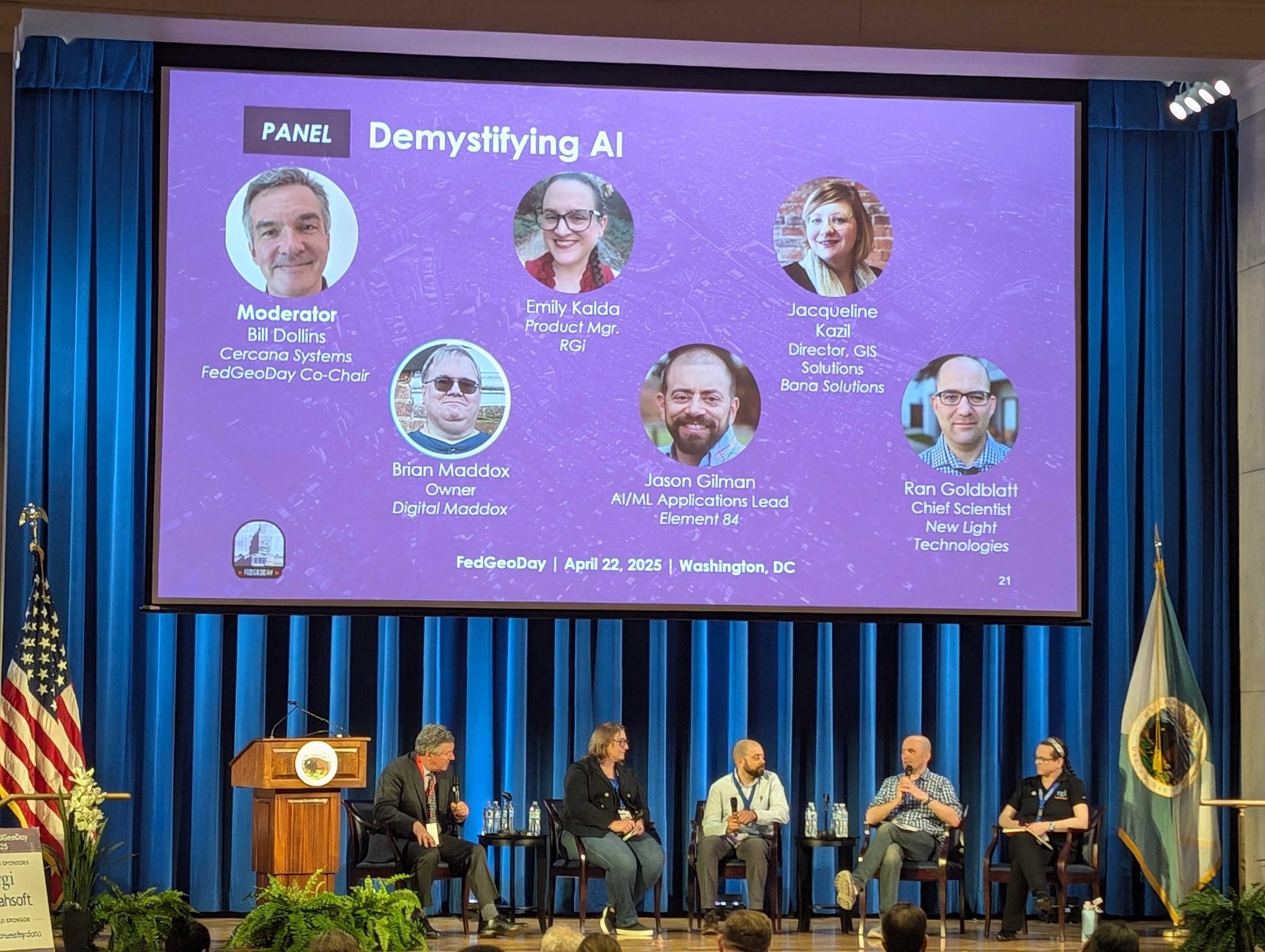
Reflections on the Process of Planning FedGeoDay 2025
What is FedGeoDay? FedGeoDay is a single-track conference dedicated to federal use-cases of open geospatial ecosystems. The open ecosystems have a wide variety of uses and forms, but largely include anything designed around open data, open source software, and open standards. The main event is a one day commitment and is followed by a day […]
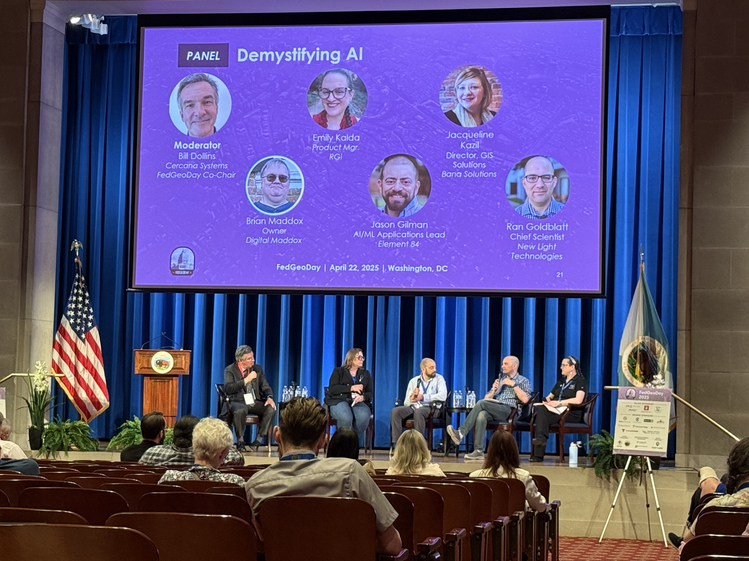

Cercana At FedGeoDay
Cercana Systems is excited to share that our entire team will be in attendance at FedGeoDay 2025! This is a great opportunity to meet with us face-to-face and learn more about our capabilities and the work we do. The event is happening April 22, 2025 at the Department of Interior’s Yates Auditorium in Washington, D.C. […]

Why Young Professionals Should Get Out of the Office and Into Industry Events
In today’s fast-paced professional world, it’s easy for young professionals to assume that hard work alone will get them ahead. While grinding at the desk and delivering results matters, relying solely on your work to speak for itself may leave you overlooked in a competitive field. Getting out of the office and into local conferences, […]
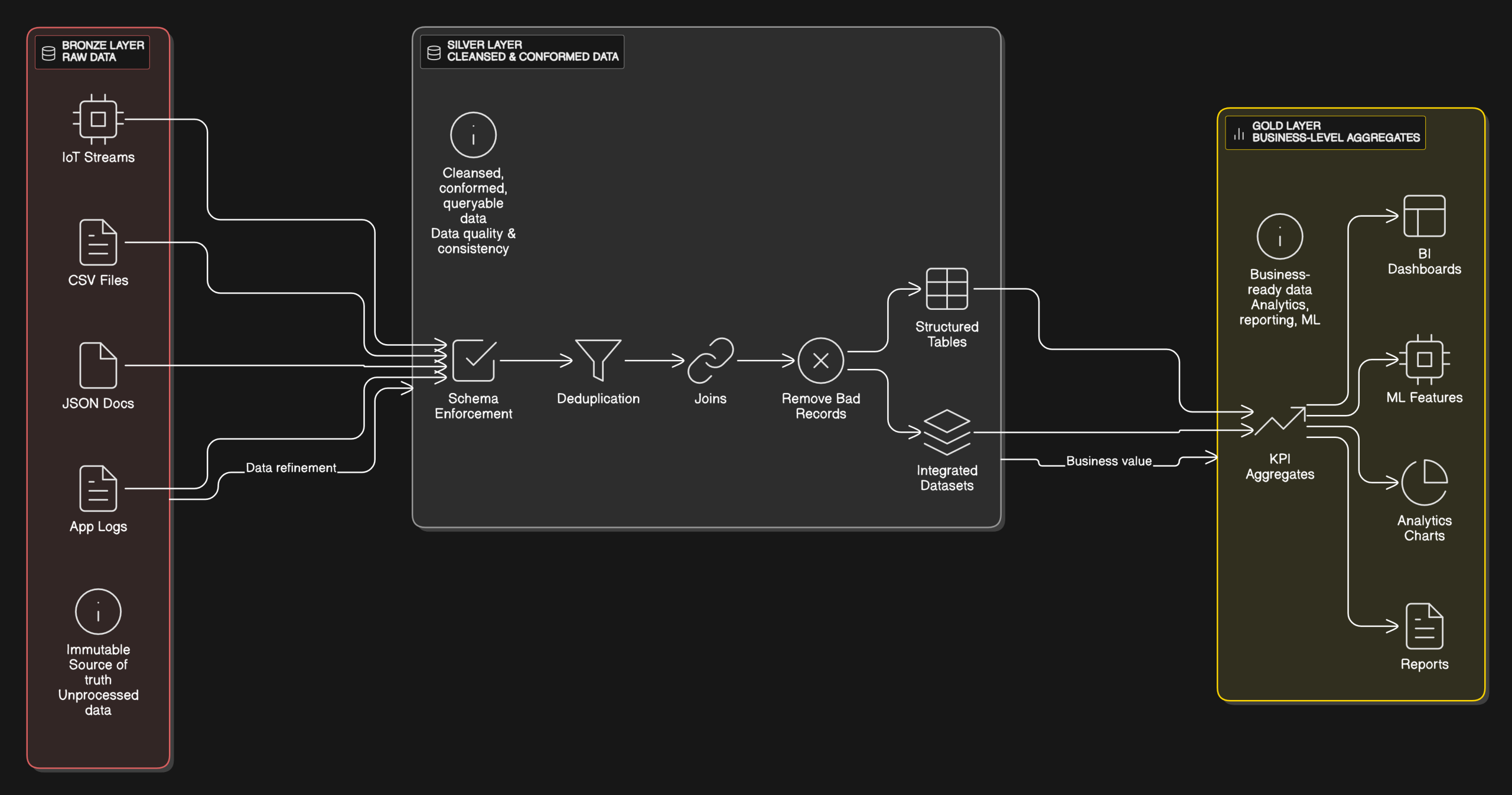
Demystifying the Medallion Architecture for Geospatial Data Processing
Introduction Geospatial data volumes and complexity are growing due to diverse sources, such as GPS, satellite imagery, and sensor data. Traditional geospatial processing methods face challenges, including scalability, handling various formats, and ensuring data consistency. The medallion architecture offers a layered approach to data management, improving data processing, reliability, and scalability. While the medallion architecture […]
Three Ways to Use GeoPandas in Your ArcGIS Workflow
Introduction When combining open-source GIS tools with the ArcGIS ecosystem, there are a handful of challenges one can encounter. The compatibility of data formats, issues with interoperability, tool chain fragmentation, and performance at scale come to mind quickly. However, the use of the open-source Python library GeoPandas can be an effective way of working around […]

Applying Porter’s Five Forces to Open-Source Geospatial
Introduction The geospatial industry has seen significant transformation with the rise of open-source solutions. Tools like QGIS, PostGIS, OpenLayers, and GDAL have provided alternatives to proprietary GIS software, providing cost-effective, customizable, and community-driven mapping and spatial analysis capabilities. While open-source GIS thrives on collaboration and accessibility, it still operates within a competitive landscape influenced by […]

Developing a Geospatially-Aware Strategic Plan for Your Organization
What is Strategic Planning and Why Does it Matter? Strategic planning is one of the most important things you can do for your organization. It helps you not only paint the picture of where you want your organization to be in the future, but also draws the roadmap for how you’re going to get there. […]

The Importance of Metadata in Geospatial Data Portfolio Management
Managing geospatial data effectively is an important challenge for organizations that use location information for decision-making. Portfolio management for geospatial data involves organizing, evaluating, and prioritizing datasets to maximize their value while minimizing redundancy, inefficiency, and cost. However, such data carries a unique set of challenges that require deliberate strategies to address. Metadata management plays […]

Geospatial Portfolio Management and Rationalization
Many organizations rely on geospatial technology to derive insights based on location and spatial relationship. Whether they are mapping infrastructure, analyzing environmental changes, or optimizing logistics, managing geospatial investments effectively is imperative. Two strategies, IT portfolio management and IT rationalization, can help organizations maximize the value of their geospatial assets while reducing inefficiencies. Leveraging the […]

Hybrid Approaches to Geospatial Architectures
At Cercana, we have worked with geospatial systems that have run the gamut—from all-in proprietary stacks to pure open-source toolchains. As the technology landscape evolves, many organizations are blending both proprietary and open-source solutions. These hybrid architectures aim to capitalize on the best of each world, providing flexibility in how users store data, serve maps, […]

Integrating AI Into Geospatial Operations
At Cercana, we’re excited by the constant evolution of geospatial technology. AI and its related technologies are becoming increasingly important components of geospatial workflows. Recently, our founder, Bill Dollins, has shared some of his explorations into AI through his personal blog, geoMusings, where he has written about topics like Named Entity Recognition (NER), image similarity […]

Choosing Between an iPaaS and Building a Custom Data Pipeline
In today’s data-driven world, integrating various systems and managing data effectively is crucial for organizations to make informed decisions and remain responsive. Two popular approaches to data integration are using an Integration Platform as a Service (iPaaS) or building a custom data pipeline. Each approach has its advantages and challenges, and the best choice depends […]

Using Hstore to Analyze OSM in PostgreSQL
OpenStreetMap (OSM) is a primary authoritative source of geographic information, offering a variety of community-validated feature types. However, efficiently querying and analyzing OSM poses unique challenges. PostgreSQL, with its hstore data type, can be a powerful tool in the data analyst’s arsenal. Understanding hstore in PostgreSQL Before getting into the specifics of OpenStreetMap, let’s understand […]

Do You Need a Data Pipeline?
Do you need a data pipeline? That depends on a few things. Does your organization see data as an input into its key decisions? Is data a product? Do you deal with large volumes of data or data from disparate sources? Depending on the answers to these and other questions, you may be looking at the need for a data pipeline. But what is a data pipeline and what are the considerations for implementing one, especially if your organization deals heavily with geospatial data? This post will examine those issues.