Introduction
When combining open-source GIS tools with the ArcGIS ecosystem, there are a handful of challenges one can encounter. The compatibility of data formats, issues with interoperability, tool chain fragmentation, and performance at scale come to mind quickly. However, the use of the open-source Python library GeoPandas can be an effective way of working around these problems. When working with GeoPandas, there’s a simple series of steps to follow – you start with the data in ArcGIS, process it with the GeoPandas library, and import it back into ArcGIS.
It is worth noting that ArcPy and GeoPandas are not mutually exclusive. Because of its tight coupling with ArcGIS, it may be advantageous to use ArcPy in parts of your workflow and pass your data off to GeoPandas for other parts. This post covers three specific ways GeoPandas can enhance ArcGIS workflows and why it can better than using ArcPy in some cases.
Scenario 1: Spatial Joins Between Large Datasets
Spatial joins in ArcPy can be computationally expensive and time-consuming, especially for large datasets, as they process row by row and write to disk. GeoPandas’ gpd.sjoin() provides a more efficient in-memory alternative for point-to-polygon and polygon-to-polygon joins, leveraging Shapely’s spatial operations. While GeoPandas can be significantly faster for moderately large datasets that fit in memory, ArcPy’s disk-based approach may handle extremely large datasets more efficiently. GeoPandas also simplifies attribute-based filtering and aggregation, making it easier to summarize data—such as joining customer locations to sales regions and calculating total sales per region. Results can be exported to ArcGIS-compatible formats, though conversion is required. For best performance, enabling spatial indexing (gdf.sindex) in GeoPandas is recommended.
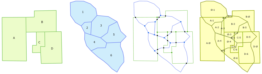
Scenario 2: Geometric Operations (Buffering, Clipping, and Dissolving Features)
Buffering and dissolving in ArcPy can be memory-intensive and time-consuming, particularly for large or complex geometries. Using functions like buffer(), clip(), and dissolve() to preprocess geometries before importing them back to ArcGIS is an effective solution to that problem. These functions can help make a multitude of processes more efficient. They can create buffer zones around road networks, dissolve any overlapping zones, and export the results as a new feature class for ArcGIS-based impact analysis.
These functions can be cleaner and more efficient with regards to geometry processing than ArcPy and require fewer steps to carry out. They also integrate well with data science workflows using pandas-like syntax.
Below is a detailed side-by-side comparison of GeoPandas and ArcPy for spatial analysis operations, specifically focusing on buffering and dissolving tasks.
| Aspect | GeoPandas 🐍 | ArcPy 🌎 |
| Processing Speed | Faster for medium-sized datasets due to vectorized NumPy/Shapely operations. Slows down with very large datasets. | Slower for smaller datasets but optimized for large-scale GIS processing due to disk-based operations. |
| Memory Usage | Fully in-memory, efficient for moderately large data but can struggle with very large datasets. | Uses ArcGIS’s optimized storage and caching mechanisms, which help handle large datasets without running out of RAM. |
| Ease of Use | Requires fewer lines of code; syntax is cleaner for many operations. | More verbose; requires handling geoprocessing environments and ArcPy-specific data structures. |
| Buffering Capabilities | Uses GeoSeries.buffer(distance), efficient but requires a projected CRS. | arcpy.Buffer_analysis(), supports geodesic buffers and larger datasets more reliably. |
| Dissolve Functionality | GeoDataFrame.dissolve(by=”column”), vectorized and fast for reasonably large data. | arcpy.Dissolve_management(), slower for small datasets but scales better for massive datasets. |
| Coordinate System Handling | Requires explicit CRS conversion for accurate distance-based operations. | Natively supports geodesic buffering (without requiring projection changes). |
| Data Formats | Works with GeoDataFrames, exports to GeoJSON, Shapefile, Parquet, etc. | Works with File Geodatabases (.gdb), Shapefiles, and enterprise GIS databases. |
| Integration with ArcGIS | Requires conversion (e.g., gdf.to_file(“data.shp”)) before using results in ArcGIS. | Seamless integration with ArcGIS software and services. |
| Parallel Processing Support | Limited parallelism (can use Dask or multiprocessing for workarounds). | Can leverage ArcGIS Pro’s built-in multiprocessing tools. |
| License Requirements | Open-source, free to use. | Requires an ArcGIS license. |
Scenario 3: Bulk Updates and Data Cleaning
When performing bulk updates (e.g., modifying attribute values, recalculating fields, or updating geometries), ArcPy and GeoPandas have different approaches and performance characteristics. ArcPy uses a cursor-based approach, applying updates row-by-row. GeoPandas uses an in-memory GeoDataframe and vectorized operations via the underlying Pandas library. This can make GeoPandas orders of magnitude faster on bulk updates than ArcPy, but it can be memory intensive. Modern computing systems generally have a lot of memory so this is rarely a concern but, if you are working in a memory-constrained environment, ArcPy may suit your needs better.
Here is a side-by-side comparison:
| Feature | GeoPandas 🐍 | ArcPy 🌎 |
| Processing Model | Uses in-memory GeoDataFrame for updates (vectorized with Pandas). | Uses a cursor-based approach (UpdateCursor), modifying records row by row. |
| Speed | Faster for large batch updates (leverages NumPy, vectorized operations). | Slower for large datasets due to row-by-row processing but scales well with large file geodatabases. |
| Memory Usage | Higher, since it loads the entire dataset into memory. | Lower, as it processes one row at a time and writes directly to disk. |
| Ease of Use | Simpler, using Pandas-like syntax. | More complex, requiring explicit cursor handling. |
| Parallel Processing | Can use multiprocessing/Dask to improve performance. | Limited, but ArcGIS Pro supports some multiprocessing tools. |
| Spatial Database Support | Works well with PostGIS, SpatiaLite, and other open formats. | Optimized for Esri File Geodatabases (.gdb) and enterprise databases. |
| File Format Compatibility | Reads/writes GeoJSON, Shapefiles, Parquet, etc. | Reads/writes File Geodatabase, Shapefile, Enterprise Databases. |
5. When to Use ArcPy Instead
There are still times that using ArcPy would be the better solution. Things like network analysis, topology validation, or tasks that require a deeper integration with ArcGIS Enterprise in some other capacity are better done in ArcPy as opposed to GeoPandas. In the case of network analysis, ArcPy integrates ArcGIS’s native network analyst extension. On its own, it supports finding the shortest path between locations, calculating service areas, origin-destination cost analysis, vehicle routing problems, and closest facility analysis. It also works natively with ArcGIS’s advanced network datasets such as turn restrictions, traffic conditions, one-way streets, and elevation-based restrictions.
6. Conclusion
GeoPandas offer greater efficiency, speed, flexibility, and simplicity when working with open-source tools in ArcGIS workflows, especially with regard to custom analysis and preprocessing. If you haven’t tried using GeoPandas before, it is more than worth your time to play around with.
Have you had your own positive or negative experiences using GeoPandas with ArcGIS? Feel free to leave them in the comments, or give us a suggestion of other workflows you would like to see a blog post about!